MyTopo
Simpson South Louisiana US Topo Map
Couldn't load pickup availability
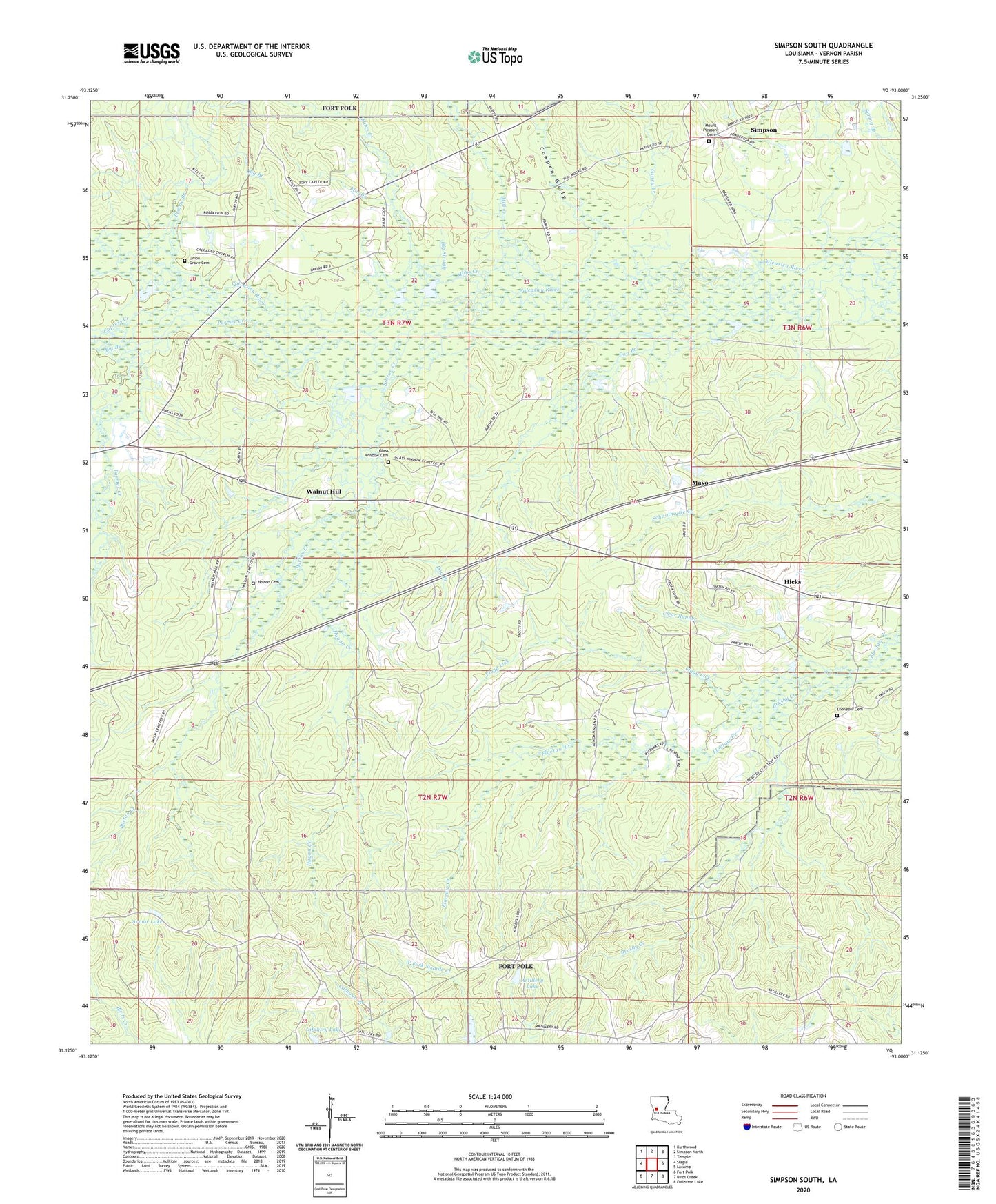
2020 topographic map quadrangle Simpson South in the state of Louisiana. Scale: 1:24000. Based on the newly updated USGS 7.5' US Topo map series, this map is in the following counties: Vernon. The map contains contour data, water features, and other items you are used to seeing on USGS maps, but also has updated roads and other features. This is the next generation of topographic maps. Printed on high-quality waterproof paper with UV fade-resistant inks.
Quads adjacent to this one:
West: Slagle
Northwest: Kurthwood
North: Simpson North
Northeast: Temple
East: Lacamp
Southeast: Fullerton Lake
South: Birds Creek
Southwest: Fort Polk
Contains the following named places: Armor Lake, Artillery Lake, Big Branch, Big Slough, Brushy Creek, Burton Creek, Caney Branch, Clear Runner, Cowpen Gully, Cypress Creek, Dog Branch, Ebenezer Cemetery, Flagg Lick, Flat Branch, Glass Window Cemetery, Hagan Creek, Hicks, Hicks Post Office, Holton Cemetery, Infantry Lake, Louisiana Noname 58 Dam, Mayo, Mill Creek, Mims Creek, Mount Pleasant Cemetery, Oak Grove Church, Parmer Creek, Prairie Branch, Range 31 Tower, Range 33D Tower, Simpson, Slagle Lake, Union Grove Cemetery, Union Grove Church, Walnut Hill, Walnut Hill Church