MyTopo
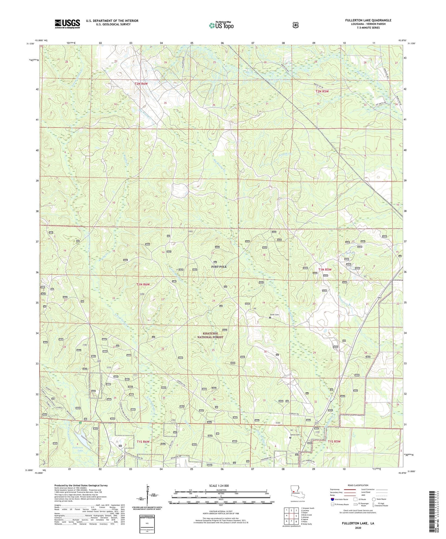
Fullerton Lake Louisiana US Topo Map
Couldn't load pickup availability
Also explore the Fullerton Lake Forest Service Topo of this same quad for updated USFS data
2024 topographic map quadrangle Fullerton Lake in the state of Louisiana. Scale: 1:24000. Based on the newly updated USGS 7.5' US Topo map series, this map is in the following counties: Vernon. The map contains contour data, water features, and other items you are used to seeing on USGS maps, but also has updated roads and other features. This is the next generation of topographic maps. Printed on high-quality waterproof paper with UV fade-resistant inks.
Quads adjacent to this one:
West: Birds Creek
Northwest: Simpson South
North: Lacamp
Northeast: Sieper
East: Afeman
Southeast: Steep Gully
South: Pitkin
Southwest: Sugrue
This map covers the same area as the classic USGS quad with code o31092a8.
Contains the following named places: Brushy Creek, Fullerton Baptist Church, Fullerton Church, Fullerton Lake, Fullerton Lake Campground and Picnic Area, Fullerton Lookout Tower, Fullerton Mill, Oak Grove Church, Parish Governing Authority District 5, Semon Cemetery, Smith Cemetery