MyTopo
Slagle Louisiana US Topo Map
Couldn't load pickup availability
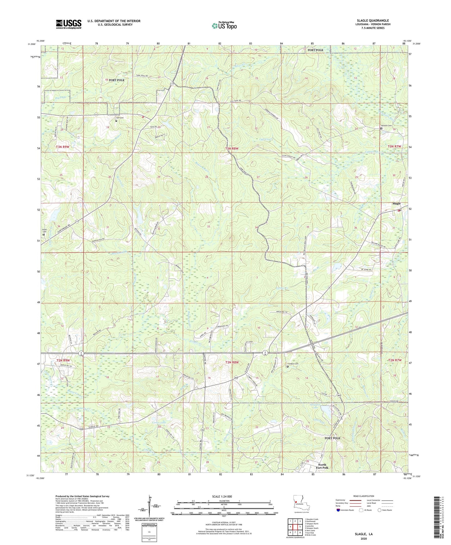
2024 topographic map quadrangle Slagle in the state of Louisiana. Scale: 1:24000. Based on the newly updated USGS 7.5' US Topo map series, this map is in the following counties: Vernon. The map contains contour data, water features, and other items you are used to seeing on USGS maps, but also has updated roads and other features. This is the next generation of topographic maps. Printed on high-quality waterproof paper with UV fade-resistant inks.
Quads adjacent to this one:
West: Leesville
Northwest: Dowden Creek
North: Kurthwood
Northeast: Simpson North
East: Simpson South
Southeast: Birds Creek
South: Fort Polk
Southwest: New Llano
This map covers the same area as the classic USGS quad with code o31093b2.
Contains the following named places: Alligator Lake, Alligator Lake Dam, Antioch Baptist Cemetery, Antioch Baptist Church, Beason Creek, Blackland Branch, Castor Baptist Church, Castor Lake, Castor Lake Dam, Cooper Creek, Dry Fork Volunteer Fire Department Station 22, East Leesville Baptist Church, East Leesville Church, Elizabeth Chapel Cemetery, Four Winds Cherokee State Designated Tribal Statistical Area, Franklin Cemetery, Mount Bethel Baptist Church, Mount Bethel Church, Mount Zion Church, Parish Governing Authority District 11, Pond Branch, Self Cemetery, Slagle, Slagle Baptist Church, Slagle Post Office, Slagle Volunteer Fire Department, Ward One, ZIP Code: 71446