
MyTopo
Vernon Louisiana US Topo Map
Couldn't load pickup availability
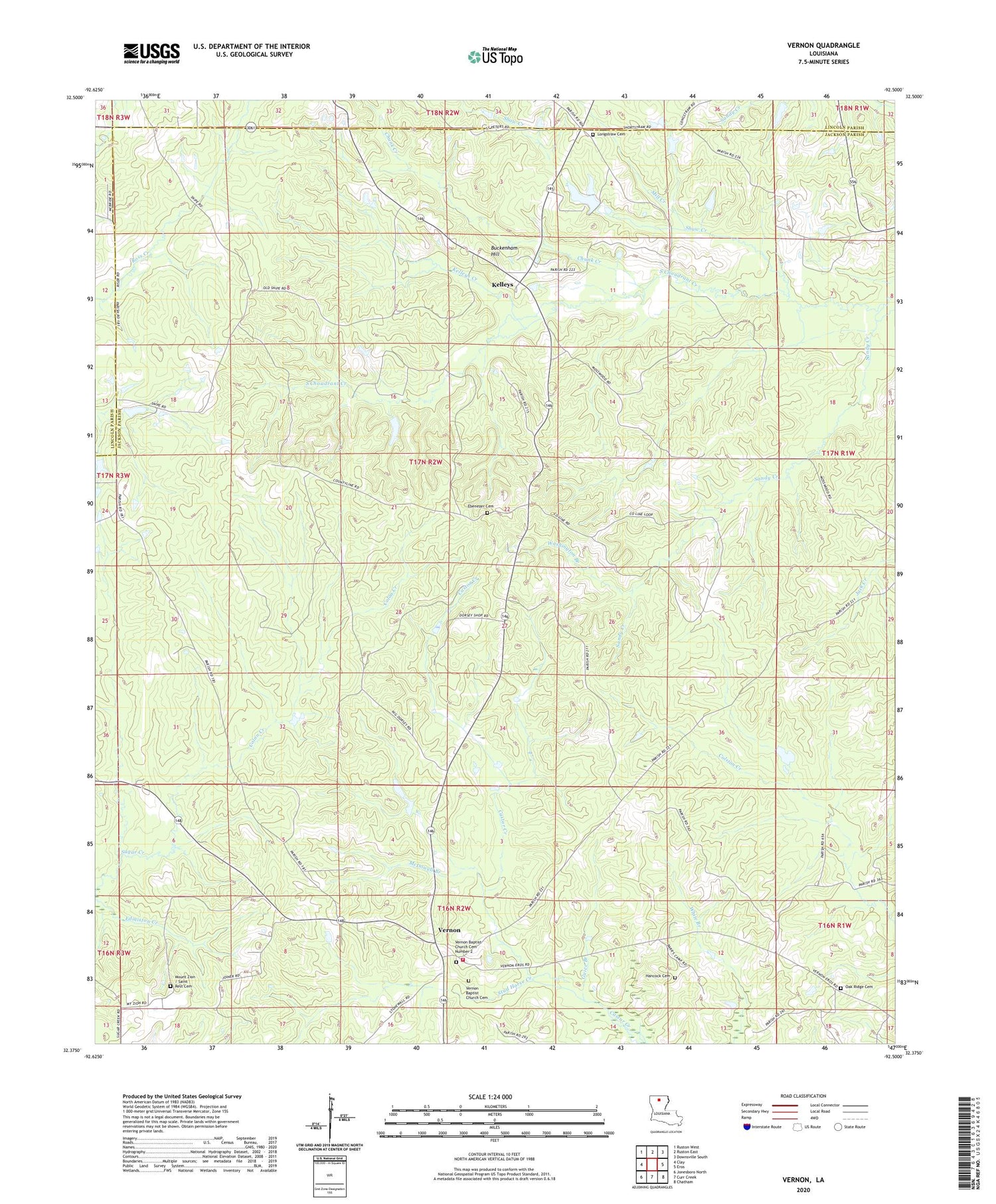
2020 topographic map quadrangle Vernon in the state of Louisiana. Scale: 1:24000. Based on the newly updated USGS 7.5' US Topo map series, this map is in the following counties: Jackson, Lincoln. The map contains contour data, water features, and other items you are used to seeing on USGS maps, but also has updated roads and other features. This is the next generation of topographic maps. Printed on high-quality waterproof paper with UV fade-resistant inks.
Quads adjacent to this one:
West: Clay
Northwest: Ruston West
North: Ruston East
Northeast: Downsville South
East: Eros
Southeast: Chatham
South: Curr Creek
Southwest: Jonesboro North
Contains the following named places: Buckenham Hill, Chunk Creek, Colon Creek, County Line Church, Ebenezer Baptist Church, Ebenezer Cemetery, Ebenzer, Guice Branch, Jackson Parish District 2 Fire Protection District, Kelleys, Kelleys Creek, Kelleys Gas Field, Kelly Pond Dam, Lamkin Pond, Longstraw, Longstraw Baptist Church, McDowell Branch, Mill Creek, Mount Pisgah Baptist Church, Mount Zion, Mount Zion / Saint Rest Cemetery, Mount Zion Baptist Church, Oak Ridge, Oak Ridge Cemetery, Oak Ridge Church, Sandy Creek, Shaw Creek, Stud Horse Creek, Vernon, Vernon Baptist Church, Vernon Baptist Church Cemetery, Vernon Gas Field, Washington Branch


