MyTopo
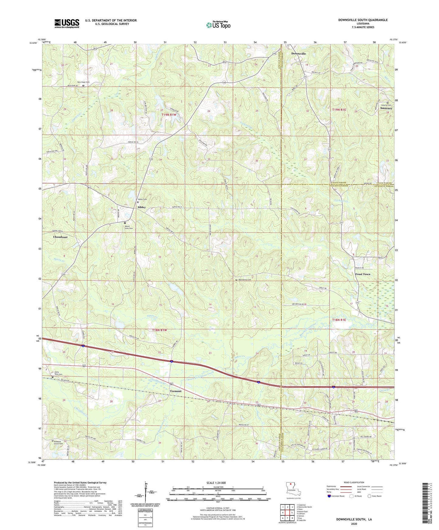
Downsville South Louisiana US Topo Map
Couldn't load pickup availability
2024 topographic map quadrangle Downsville South in the state of Louisiana. Scale: 1:24000. Based on the newly updated USGS 7.5' US Topo map series, this map is in the following counties: Lincoln, Ouachita, Union. The map contains contour data, water features, and other items you are used to seeing on USGS maps, but also has updated roads and other features. This is the next generation of topographic maps. Printed on high-quality waterproof paper with UV fade-resistant inks.
Quads adjacent to this one:
West: Ruston East
Northwest: Cedarton
North: Downsville North
Northeast: Point
East: Calhoun
Southeast: Cadeville
South: Eros
Southwest: Vernon
This map covers the same area as the classic USGS quad with code o32092e4.
Contains the following named places: Atley Donaldson Pond Dam, Averit, Beulah Church, Calhoun Church, Choudrant Creek, Choudrant Elementary School, Clear Creek, Downsville Community Charter School, Frost Town, Lane School, Lanes Chapel, Macedonia Church, Macedonia School, Mount Sinai Church, New Hope Baptist Church, North Carlton Gas Field, Parish Governing Authority District 5, Pleasant Grove Baptist Church, Pleasant Grove Cemetery, Pleasant Grove School, Pleasant Valley, Pleasant Valley Assembly of God Church, Saints Rest Church, Sibley, Smurney, Smyrna Cemetery, South Choudrant Creek, South Downsville Gas Field, Squire Creek, Tremont, Tremont Gas Field, Zion Traveler Baptist Church, ZIP Code: 71227