MyTopo
Bradford Maine US Topo Map
Couldn't load pickup availability
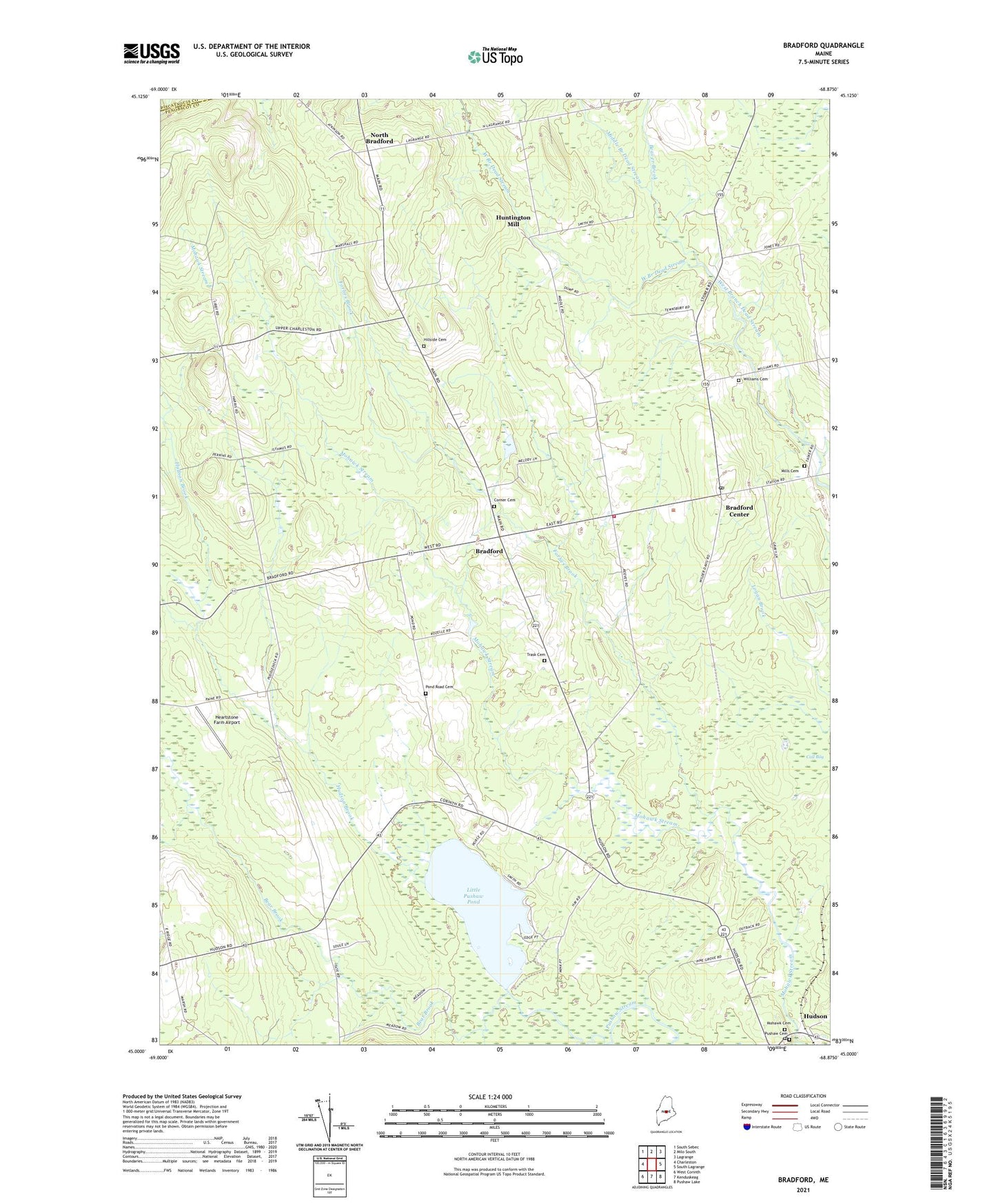
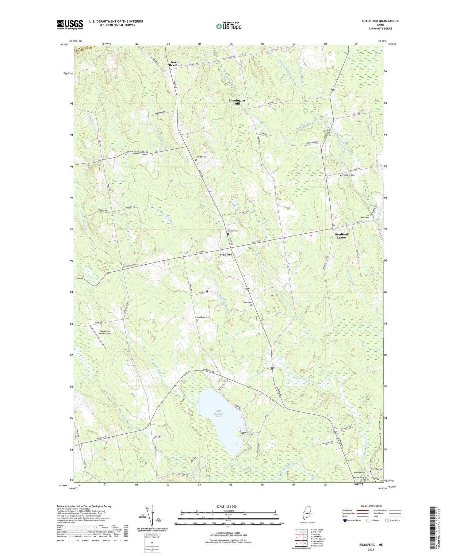
2021 topographic map quadrangle Bradford in the state of Maine. Scale: 1:24000. Based on the newly updated USGS 7.5' US Topo map series, this map is in the following counties: Penobscot, Piscataquis. The map contains contour data, water features, and other items you are used to seeing on USGS maps, but also has updated roads and other features. This is the next generation of topographic maps. Printed on high-quality waterproof paper with UV fade-resistant inks.
Quads adjacent to this one:
West: Charleston
Northwest: South Sebec
North: Milo South
Northeast: Lagrange
East: South Lagrange
Southeast: Pushaw Lake
South: Kenduskeag
Southwest: West Corinth
Contains the following named places: Bear Brook, Beaver Brook, Bradford, Bradford Baptist Church, Bradford Center, Bradford Elementary School, Bradford Emergency Medical Ambulance Service, Bradford Fire and Rescue Department, Bradford High School, Bradford Post Office, Corner Cemetery, Davis Brook, Forbes Brook, Heartstone Farm Airport, Hillside Cemetery, Hudson, Hudson Brook, Hudson Post Office, Huntington Mill, John B Curtis Free Public Library, Keyser Brook, Little Pushaw Pond, Middle Branch Dead Stream, Mills Cemetery, Mohawk Stream, North Bradford, North Bradford School, Pond Road Cemetery, Town of Bradford, Trask Cemetery, Williams Cemetery, Williams School, ZIP Code: 04410