MyTopo
Pushaw Lake Maine US Topo Map
Couldn't load pickup availability
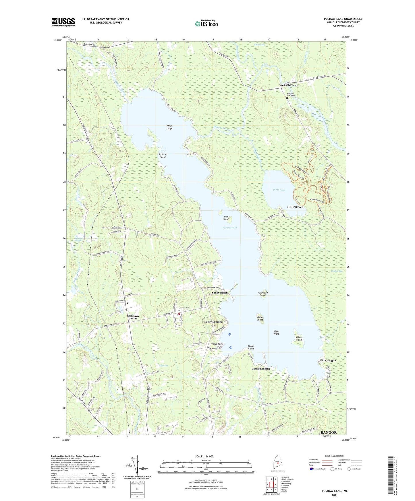
2024 topographic map quadrangle Pushaw Lake in the state of Maine. Scale: 1:24000. Based on the newly updated USGS 7.5' US Topo map series, this map is in the following counties: Penobscot. The map contains contour data, water features, and other items you are used to seeing on USGS maps, but also has updated roads and other features. This is the next generation of topographic maps. Printed on high-quality waterproof paper with UV fade-resistant inks.
Quads adjacent to this one:
West: Kenduskeag
Northwest: Bradford
North: South Lagrange
Northeast: Greenbush
East: Old Town
Southeast: Veazie
South: Bangor
Southwest: Hermon
This map covers the same area as the classic USGS quad with code o44068h7.
Contains the following named places: Camp Telok, Caribou Bog, Cunningham Landing, Dead Stream, Dollar Island, Double A Landing, Double A Seaplane Base, Dufour Landing, Elliot Landing, French Point, Glenburn and Hudson Ambulance Service, Glenburn Center, Glenburn Elementary School, Glenburn Evangelical Church, Glenburn Fire Department, Glenburn Library, Gould Landing, Hardwood Island, Hollis Bog, Lakeside Landing, Lakeview Cemetery, Lancaster Brook, Lucky Landing, Lucky Landing Marina and Seaplane Base, Mags Ledge, Marston Meadow, Moose Island, Mouse Island, Mud Stream, Old Town Landing, Perch Pond, Pug Brook, Pushaw Lake, Pushaw Lake Dam, Ram Island, Sandy Beach, Squirrel Island, Town of Glenburn, Twin Islands, Villa Vaughn, West Old Town