MyTopo
Milo South Maine US Topo Map
Couldn't load pickup availability
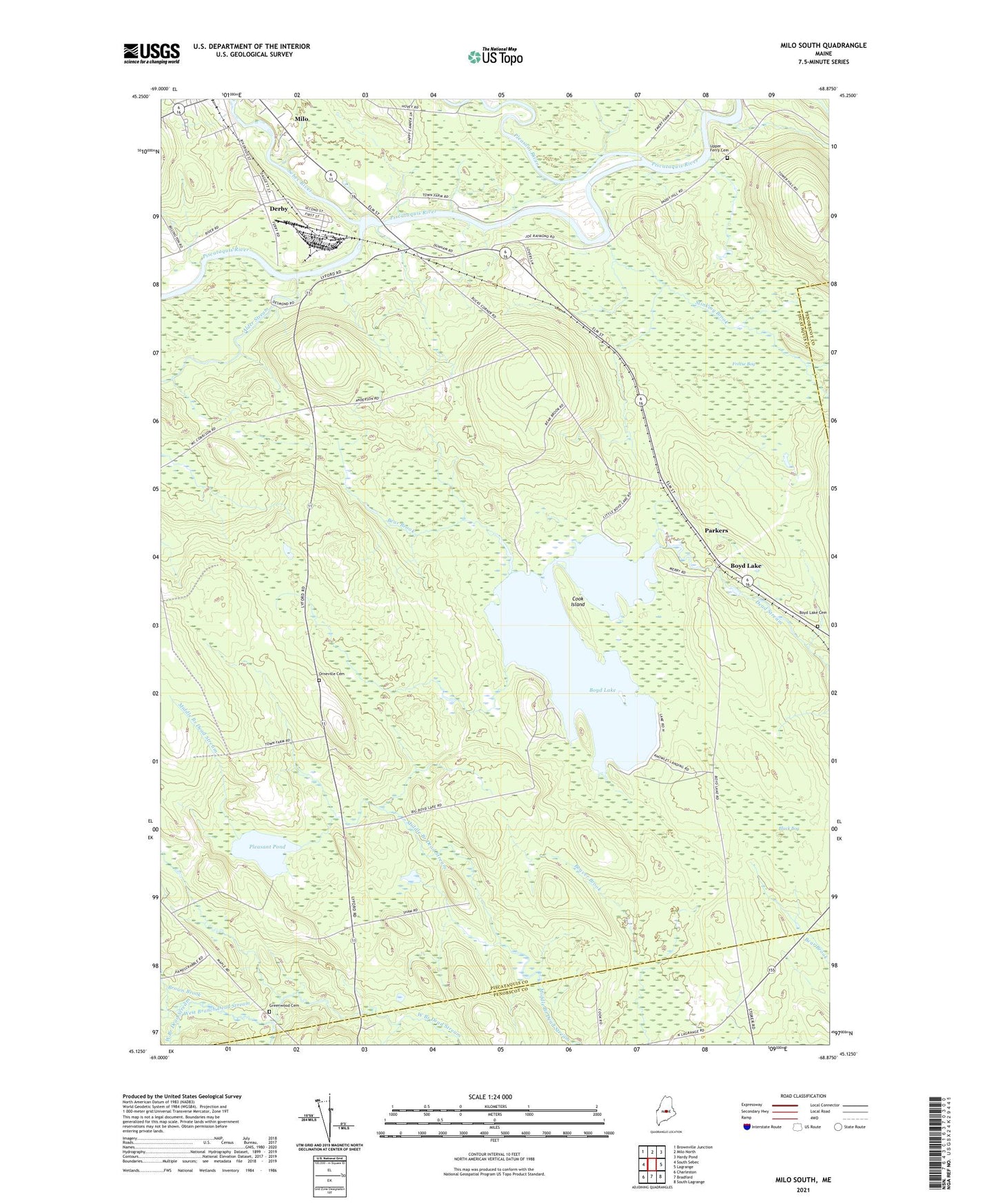
2024 topographic map quadrangle Milo South in the state of Maine. Scale: 1:24000. Based on the newly updated USGS 7.5' US Topo map series, this map is in the following counties: Piscataquis, Penobscot. The map contains contour data, water features, and other items you are used to seeing on USGS maps, but also has updated roads and other features. This is the next generation of topographic maps. Printed on high-quality waterproof paper with UV fade-resistant inks.
Quads adjacent to this one:
West: South Sebec
Northwest: Brownville Junction
North: Milo North
Northeast: Hardy Pond
East: Lagrange
Southeast: South Lagrange
South: Bradford
Southwest: Charleston
This map covers the same area as the classic USGS quad with code o45068b8.
Contains the following named places: Alder Stream, Bear Brook, Black Bog, Boyd Lake, Boyd Lake Cemetery, Brown Brook, Cook Island, Derby, Freese Bog, Greenwood Cemetery, Medford Lookout Tower, Milo Census Designated Place, Orneville Cemetery, Orneville School, Orneville Township, Parkers, Pleasant Pond, Pleasant River, Sebec River, Stinking Brook, Storers Corner, Unorganized Territory of Southeast Piscataquis, Upper Ferry, Upper Ferry Cemetery