MyTopo
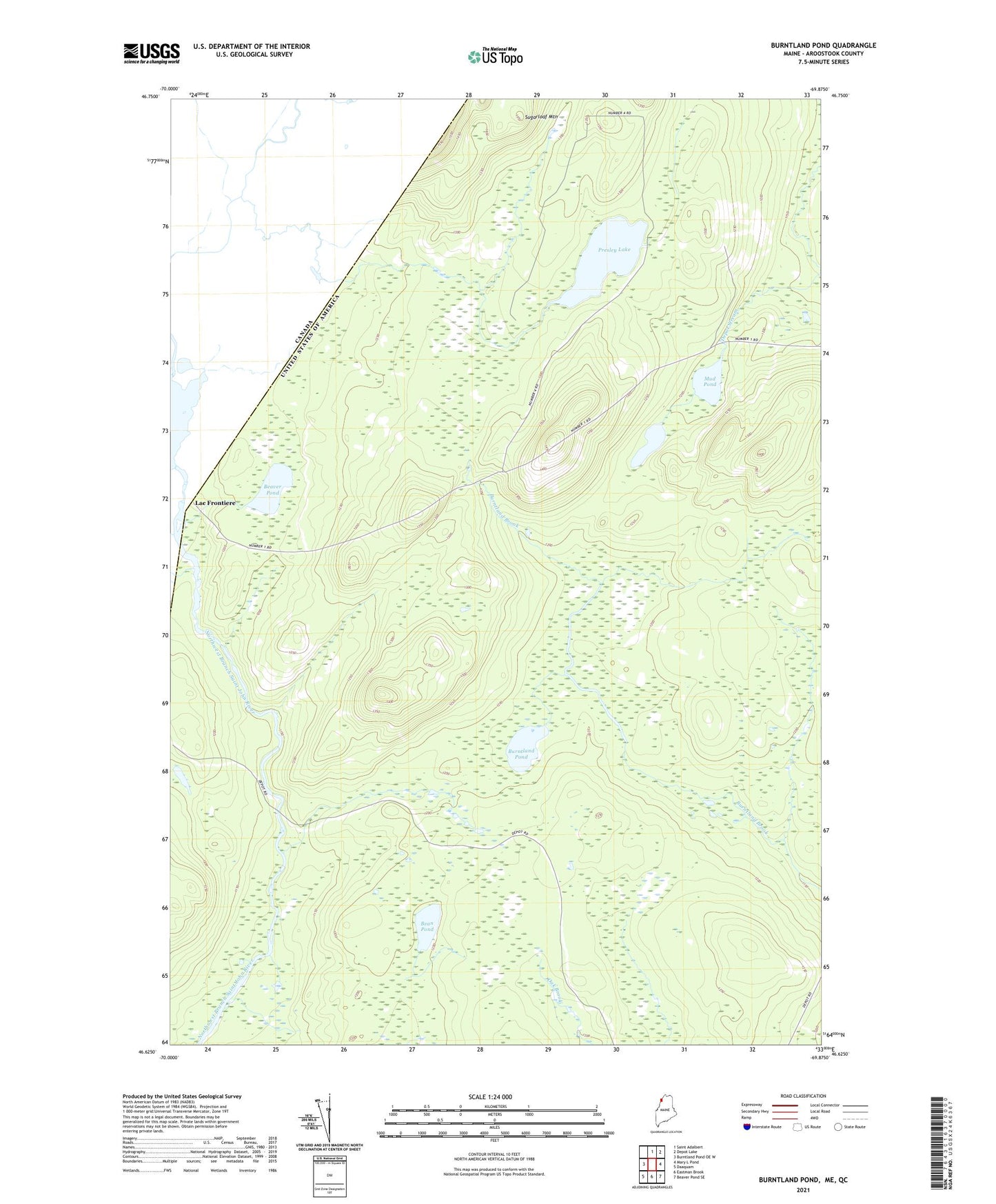
Burntland Pond Maine US Topo Map
Couldn't load pickup availability
2024 topographic map quadrangle Burntland Pond in the state of Maine. Scale: 1:24000. Based on the newly updated USGS 7.5' US Topo map series, this map is in the following counties: Aroostook. The map contains contour data, water features, and other items you are used to seeing on USGS maps, but also has updated roads and other features. This is the next generation of topographic maps. Printed on high-quality waterproof paper with UV fade-resistant inks.
Quads adjacent to this one:
West: Burntland Pond OE W
North: Saint Adalbert
Northeast: Depot Lake
East: Mary L Pond
Southeast: Beaver Pond SE
South: Eastman Brook
Southwest: Daaquam
This map covers the same area as the classic USGS quad with code o46069f8.
Contains the following named places: Bean Pond, Beaver Pond, Burntland Pond, Lac Frontiere, Little Presley Lake, Mud Pond, Presley Lake, Sugarloaf Mountain, T12 R17 WELS