MyTopo
Carmel Maine US Topo Map
Couldn't load pickup availability
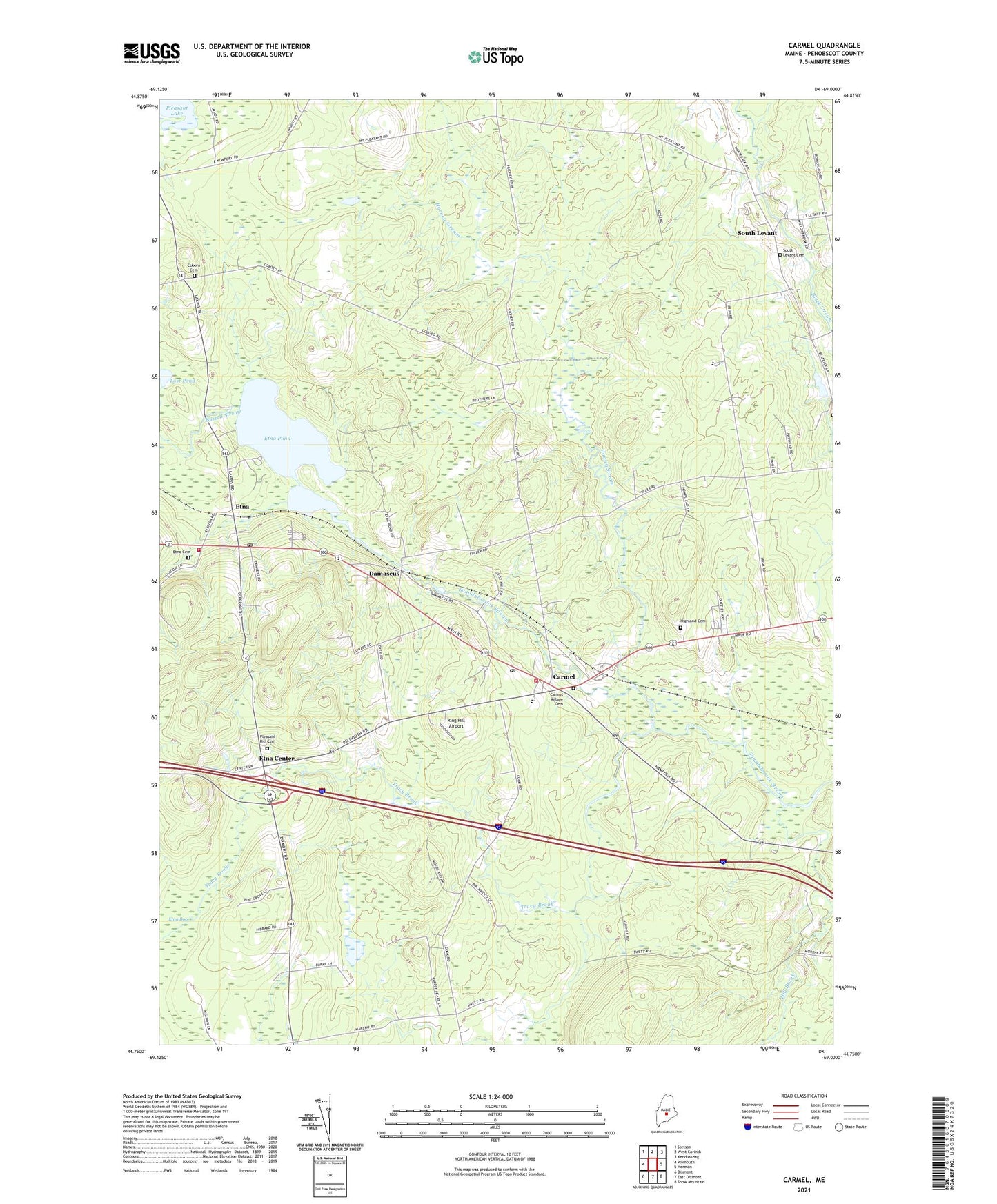
2021 topographic map quadrangle Carmel in the state of Maine. Scale: 1:24000. Based on the newly updated USGS 7.5' US Topo map series, this map is in the following counties: Penobscot. The map contains contour data, water features, and other items you are used to seeing on USGS maps, but also has updated roads and other features. This is the next generation of topographic maps. Printed on high-quality waterproof paper with UV fade-resistant inks.
Quads adjacent to this one:
West: Plymouth
Northwest: Stetson
North: West Corinth
Northeast: Kenduskeag
East: Hermon
Southeast: Snow Mountain
South: East Dixmont
Southwest: Dixmont
Contains the following named places: Buzzell Stream, Camp Etna, Caravel Middle School, Carmel, Carmel Bible Conference, Carmel Elementary School, Carmel Fire Department and Rescue, Carmel Post Office, Carmel Valley Golf Club, Carmel Village Cemetery, Coboro Cemetery, Damascus, Etna, Etna Bog, Etna Cemetery, Etna Center, Etna Pond, Etna Post Office, Etna Volunteer Fire Department, Glory Chapel, Harvey Stream, Highland Cemetery, Hill Brook, Longfellow School, Lost Pond, Pleasant Hill Cemetery, Ring Hill Airport, Simpson Memorial Library, South Levant, South Levant Baptist Church, Town of Carmel, Tracy Brook, ZIP Codes: 04419, 04488