MyTopo
Hermon Maine US Topo Map
Couldn't load pickup availability
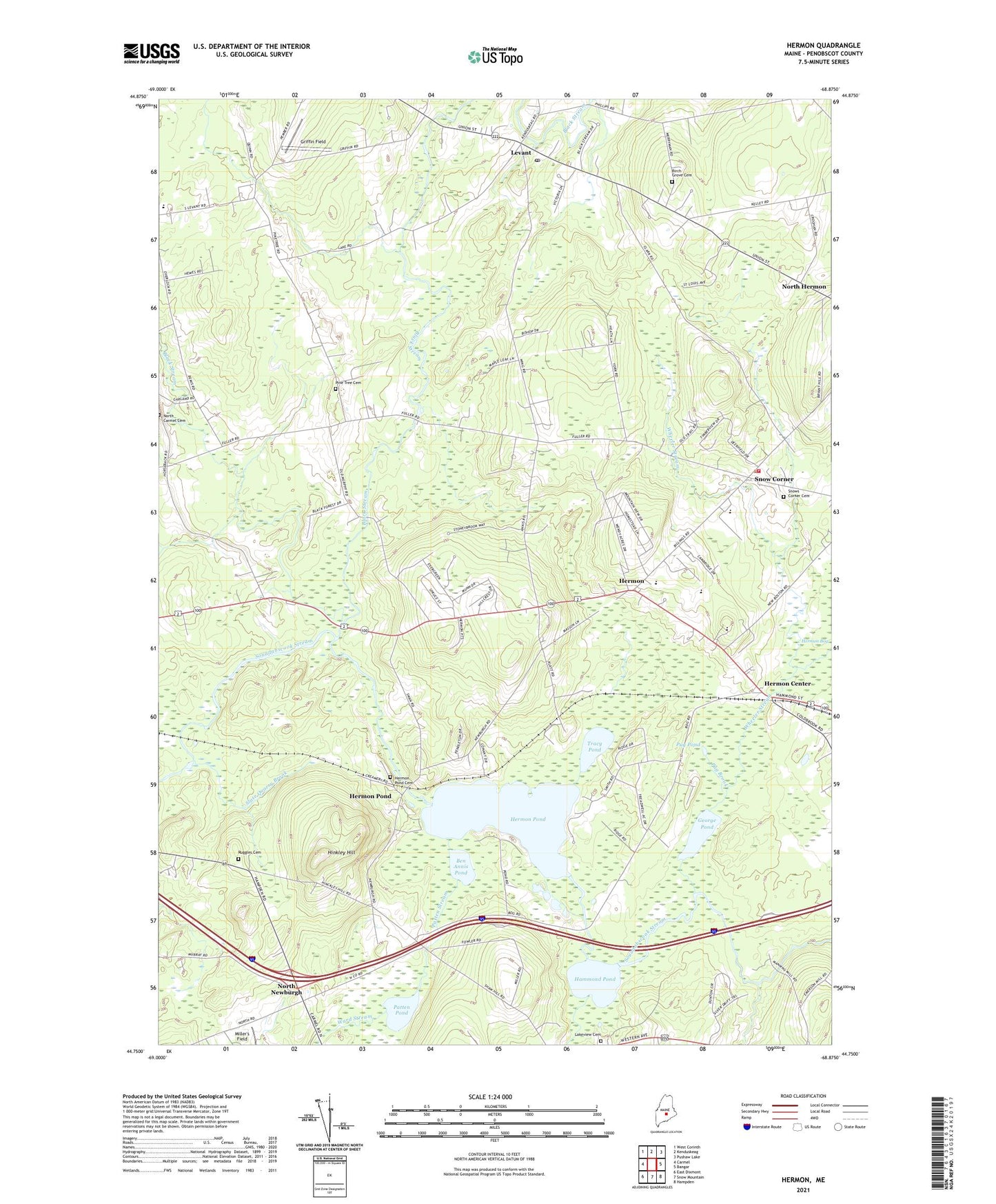
2024 topographic map quadrangle Hermon in the state of Maine. Scale: 1:24000. Based on the newly updated USGS 7.5' US Topo map series, this map is in the following counties: Penobscot. The map contains contour data, water features, and other items you are used to seeing on USGS maps, but also has updated roads and other features. This is the next generation of topographic maps. Printed on high-quality waterproof paper with UV fade-resistant inks.
Quads adjacent to this one:
West: Carmel
Northwest: West Corinth
North: Kenduskeag
Northeast: Pushaw Lake
East: Bangor
Southeast: Hampden
South: Snow Mountain
Southwest: East Dixmont
This map covers the same area as the classic USGS quad with code o44068g8.
Contains the following named places: Ben Annis Pond, Birch Grove Cemetery, Black Stream, Dabscook Crossover, Fowler Landing, George Pond, Griffin Field, Hammond Pond, Hermon, Hermon Baptist Church, Hermon Center, Hermon Creative Playground, Hermon Fire Department, Hermon High School, Hermon Meadows Golf Club, Hermon Middle School, Hermon Pond, Hermon Pond Cemetery, Hermon Volunteer Rescue Ambulance, Hinkley Hill, Lakeview Cemetery, Leathers Corner, Levant, Levant Consolidated School, Levant Heritage Library, Levant Post Office, Levant Village Baptist Church, Miller's Field, North Carmel Cemetery, North Hermon, North Newburgh, North Star Christian School, Patricia A Duran School, Patten Pond, Patten Stream, Pine Tree Cemetery, Pleasant Hill Campground, Pug Brook, Pug Pond, Ruggles Cemetery, Slate Quarry Brook, Snow Corner, Snows Corner Cemetery, Suzanne Smith Elementary School, The Black Woods, Town of Hermon, Tracy Pond, Ward Stream, West Branch Souadabscook Stream, Wheeler Stream, Wheeler Stream Camping Area