MyTopo
Plymouth Maine US Topo Map
Couldn't load pickup availability
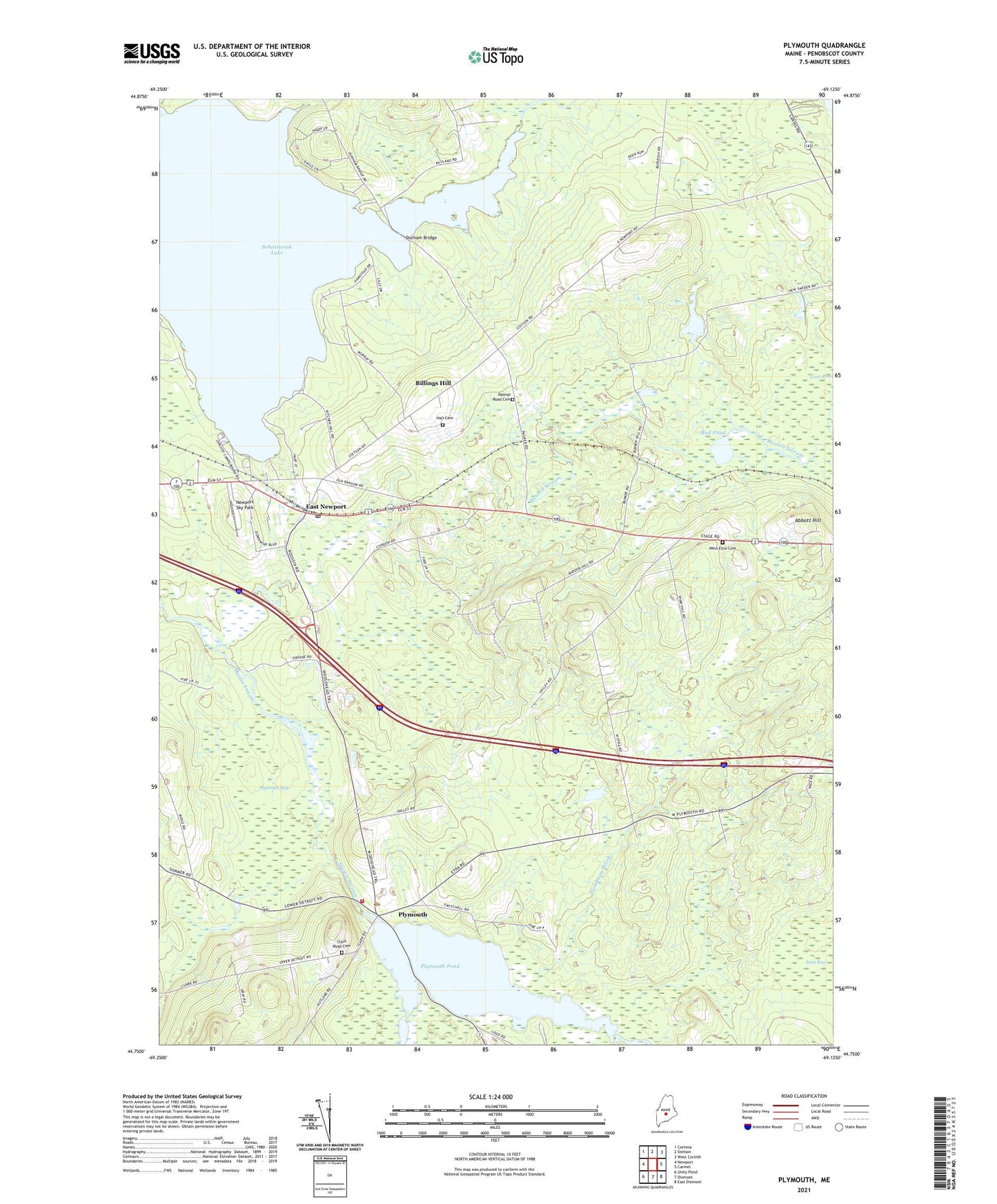
2024 topographic map quadrangle Plymouth in the state of Maine. Scale: 1:24000. Based on the newly updated USGS 7.5' US Topo map series, this map is in the following counties: Penobscot. The map contains contour data, water features, and other items you are used to seeing on USGS maps, but also has updated roads and other features. This is the next generation of topographic maps. Printed on high-quality waterproof paper with UV fade-resistant inks.
Quads adjacent to this one:
West: Newport
Northwest: Corinna
North: Stetson
Northeast: West Corinth
East: Carmel
Southeast: East Dixmont
South: Dixmont
Southwest: Unity Pond
This map covers the same area as the classic USGS quad with code o44069g2.
Contains the following named places: Abbott Hill, Billings Hill, Christies Campground, Durham Bridge, East Newport, East Newport Post Office, Emmanuel Church, Hall Cemetery, Moosehead Trail, Mud Pond, Newport Sky Park, Palmer Road Cemetery, Pleasant Lake Shores Campground, Plymouth, Plymouth Bog, Plymouth Fire and Rescue Department, Plymouth Pond, Plymouth Pond Dam, Plymouth Post Office, Sebasticook Lake, Stetson Stream, Tent Village Campground, Town of Etna, Town of Newport, Town of Plymouth, Washington School, West Etna Cemetery, Woodman Brook, ZIP Codes: 04434, 04933, 04953, 04969