MyTopo
Caucomgomoc Lake West Maine US Topo Map
Couldn't load pickup availability
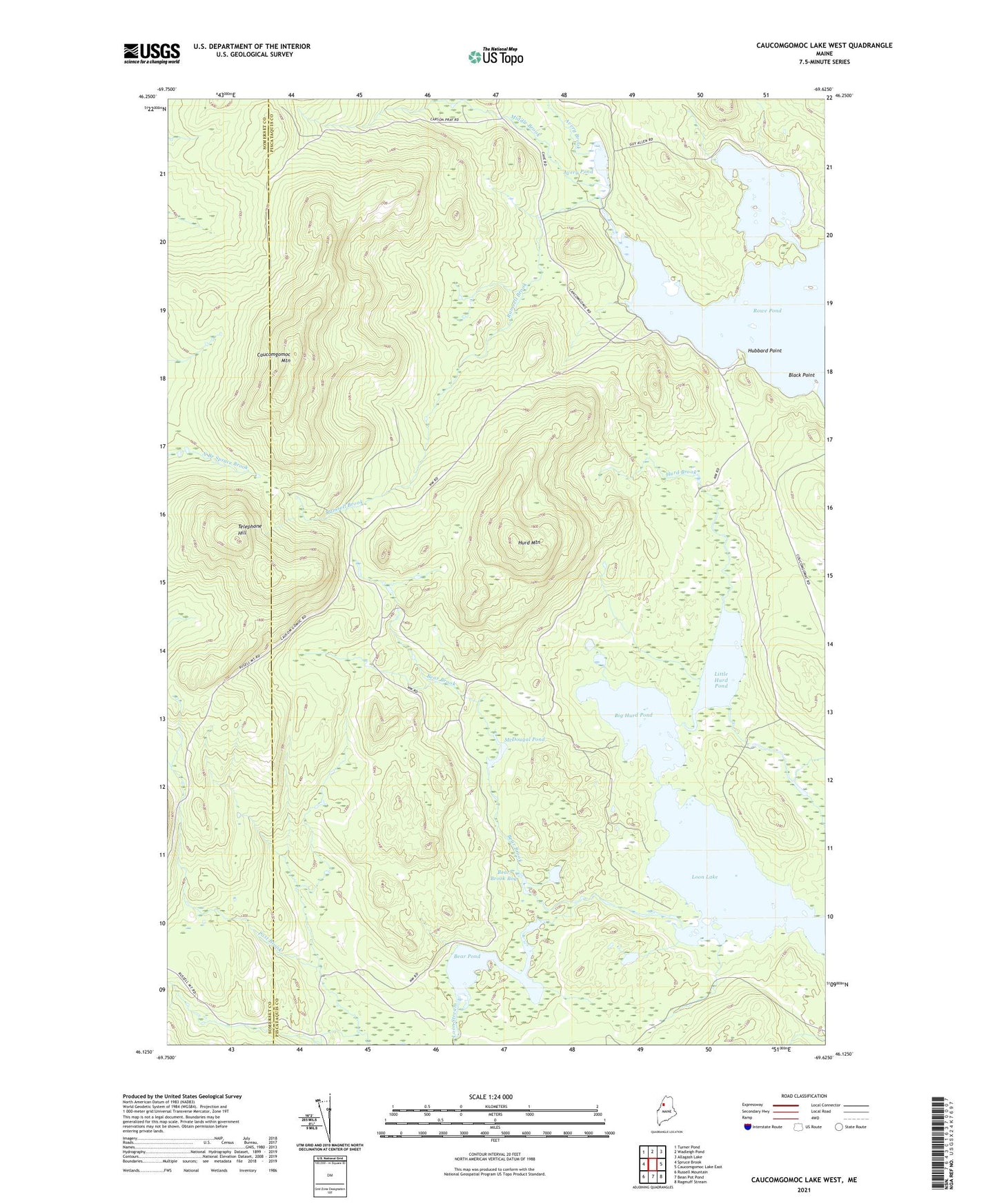
2024 topographic map quadrangle Caucomgomoc Lake West in the state of Maine. Scale: 1:24000. Based on the newly updated USGS 7.5' US Topo map series, this map is in the following counties: Piscataquis, Somerset. The map contains contour data, water features, and other items you are used to seeing on USGS maps, but also has updated roads and other features. This is the next generation of topographic maps. Printed on high-quality waterproof paper with UV fade-resistant inks.
Quads adjacent to this one:
West: Spruce Brook
Northwest: Turner Pond
North: Wadleigh Pond
Northeast: Allagash Lake
East: Caucomgomoc Lake East
Southeast: Ragmuff Stream
South: Bean Pot Pond
Southwest: Russell Mountain
This map covers the same area as the classic USGS quad with code o46069b6.
Contains the following named places: Avery Brook, Avery Pond, Bear Brook, Bear Brook Bog, Bear Pond, Big Hurd Pond, Black Point, Caucomgomoc Mountain, Hubbard Point, Hurd Brook, Hurd Mountain, Little Hurd Pond, Loon Lake, McDougal Pond, Middle Brook, Post Brook, Ramsell Brook, T6 R15 WELS, Telephone Hill