MyTopo
Center Lovell Maine US Topo Map
Couldn't load pickup availability
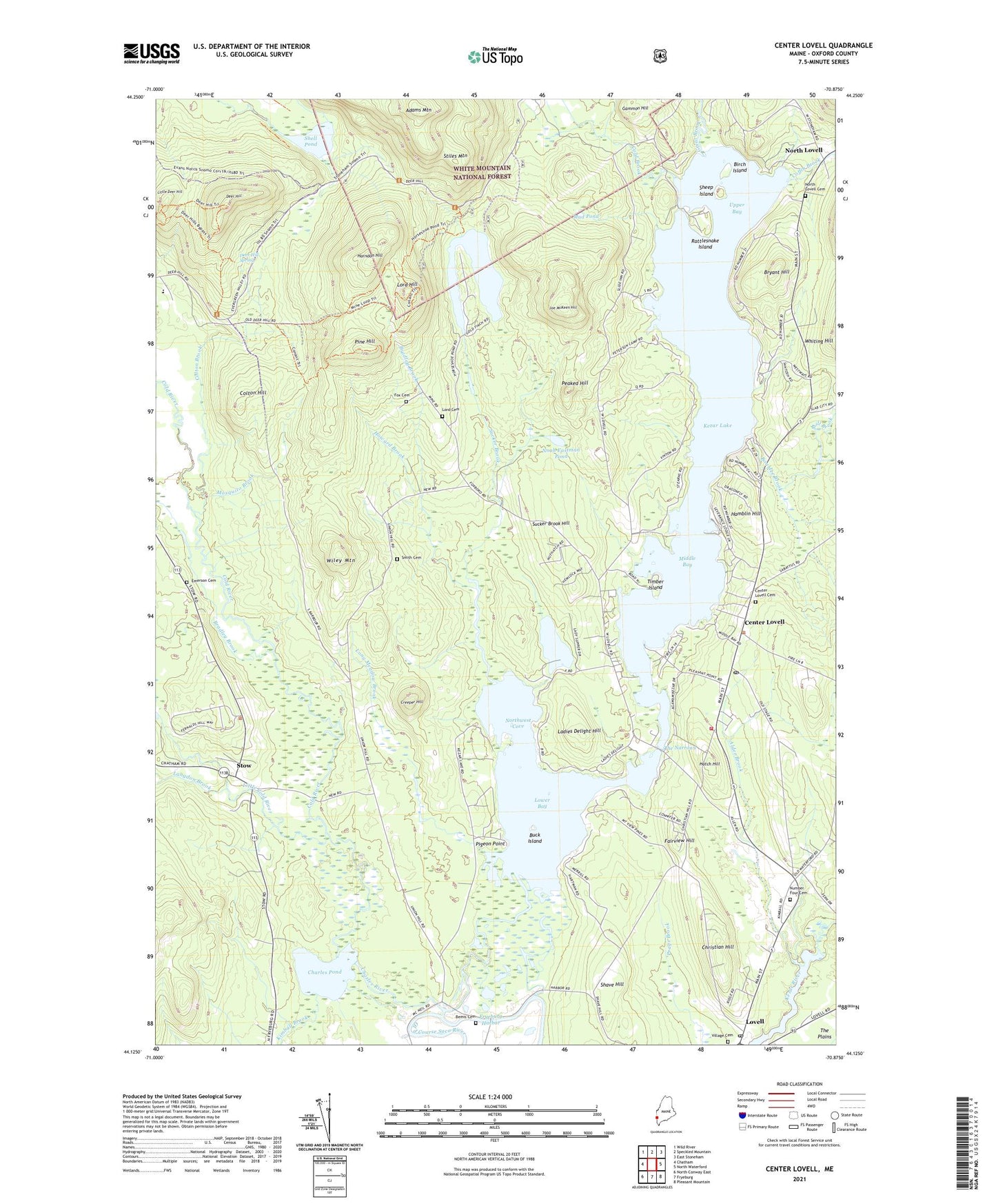
2021 topographic map quadrangle Center Lovell in the state of Maine. Scale: 1:24000. Based on the newly updated USGS 7.5' US Topo map series, this map is in the following counties: Oxford. The map contains contour data, water features, and other items you are used to seeing on USGS maps, but also has updated roads and other features. This is the next generation of topographic maps. Printed on high-quality waterproof paper with UV fade-resistant inks.
Quads adjacent to this one:
West: Chatham
Northwest: Wild River
North: Speckled Mountain
Northeast: East Stoneham
East: North Waterford
Southeast: Pleasant Mountain
South: Fryeburg
Southwest: North Conway East
Contains the following named places: Adams Mountain, Alder Brook, Andrews Brook, Bemis Cemetery, Birch Island, Boulder Brook, Bradley Brook, Bradley Church, Bryant Hill, Buck Island, Camp Aqawam, Camp Mudiekewis, Center Lovell, Center Lovell Cemetery, Center Lovell Post Office, Charles Pond, Charles River, Charlotte Hobbs Memorial Library, Christian Hill, Coffin Brook, Cold Brook, Cold River, Colton Brook, Colton Brook Dam, Colton Dam, Colton Hill, Creeper Hill, Deer Hill, Deer Hill Spring, Emerson Cemetery, Fairview Hill, Farrington Pond, Fox Cemetery, Fryeburg Harbor, Gammon Hill, Great Brook, Hamblin Hill, Harndon Hill, Hatch Hill, Horseshoe Pond, Howard Brook, Joe McKeen Hill, Kezar Lake, Kezar Lake Camp, Kezar Lake Dam, Kezar Outlet, Ladies Delight Hill, Lake Kezar Country Club, Langdon Brook, Little Cold River, Little Deer Hill, Long Meadow Brook, Lord Cemetery, Lord Hill, Lovell, Lovell Post Office, Lovell United Church of Christ, Lovell Volunteer Fire Department Central Station, Lower Bay, Martin Brook, McDonough Brook, McDonough Brook Dam, Middle Bay, Mill Brook, Moose Pond, Mosquito Brook, Mud Pond, Noah Eastman Pond, North Lovell, North Lovell Cemetery, Northwest Cove, Number Four, Number Four Cemetery, Peaked Hill, Pigeon Point, Pine Hill, Rattlesnake Brook, Rattlesnake Island, Shave Hill, Sheep Island, Shell Pond, Smith Cemetery, Stiles Mountain, Stow, Sucker Brook, Sucker Brook Hill, Summit Achievement School, The Narrows, Timber Island, Town of Lovell, Town of Stow, Upper Bay, Village Cemetery, Waterthrush Brook, Wiley Mountain, ZIP Code: 04051