MyTopo
Fryeburg Maine US Topo Map
Couldn't load pickup availability
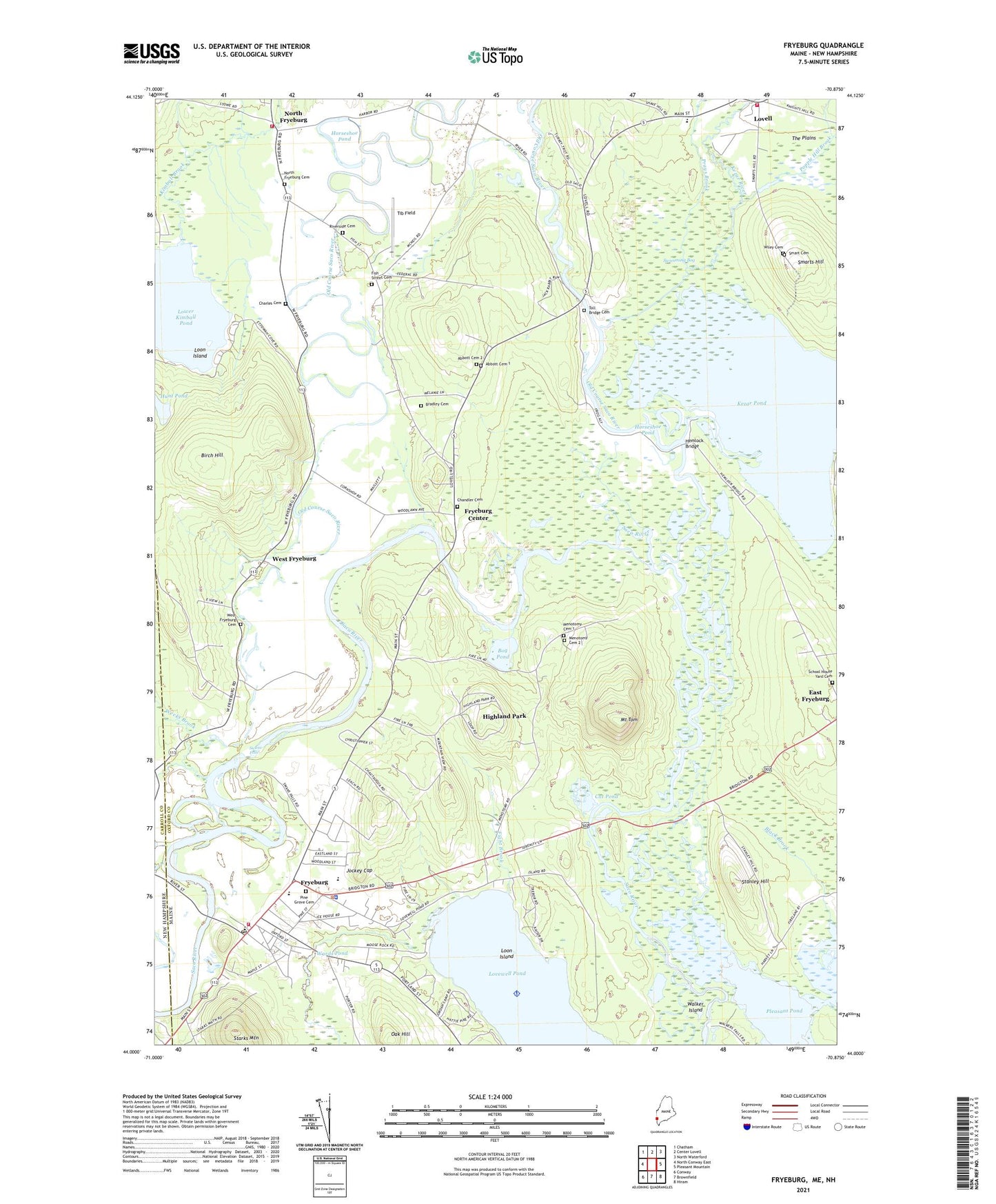
2024 topographic map quadrangle Fryeburg in the states of Maine, New Hampshire. Scale: 1:24000. Based on the newly updated USGS 7.5' US Topo map series, this map is in the following counties: Oxford, Carroll. The map contains contour data, water features, and other items you are used to seeing on USGS maps, but also has updated roads and other features. This is the next generation of topographic maps. Printed on high-quality waterproof paper with UV fade-resistant inks.
Quads adjacent to this one:
West: North Conway East
Northwest: Chatham
North: Center Lovell
Northeast: North Waterford
East: Pleasant Mountain
Southeast: Hiram
South: Brownfield
Southwest: Conway
Contains the following named places: Abbott Cemetery 1, Abbott Cemetery 2, Adams School, Birch Hill, Black Brook, Bog Pond, Bradley Cemetery, Bradley Memorial Park, Cat Pond, Chandler Cemetery, Charles Cemetery, Charles Snow School, Church of the New Jerusalem, Dead Lake, District Number One Schoolhouse, Fight Brook, First Assembly of God Church, First Church of Christ Scientist, First Congregational Church, Fish Street, Fish Street Cemetery, Fryeburg, Fryeburg Academy, Fryeburg Census Designated Place, Fryeburg Center, Fryeburg Dam, Fryeburg Fair Farm Museum, Fryeburg Fairgrounds, Fryeburg Fire Department, Fryeburg Police Department, Fryeburg Post Office, Fryeburg Public Library, Fryeburg Rescue Station Ambulance Service, Hemlock Bridge, Highland Park, Horseshoe Pond, Hunt Pond, Jockey Cap, Kezar Pond, Kezar River, Kezar River Mill Dam, Kimball Brook, Loon Island, Lovell Volunteer Fire Department Village Station, Lovewell Pond, Lower Kimball Pond, Main Street Historic District, Menotomy Cemetery 1, Menotomy Cemetery 2, Mill Pond, Molly Ockett Middle School, Mount Tom, New Life Christian Academy, New Suncook Elementary School, North Fryeburg, North Fryeburg Cemetery, Oak Hill, Old Course Saco River, Pine Grove Cemetery, Pleasant Pond, Popple Hill Brook, Prays Brook, Riverside Cemetery, Saco River Reservoir, Saco Valley Fire Department Station 1, Sadie F Adams School, Saint Elizabeth Ann Seton Church, School House Yard Cemetery, Smart Cemetery, Smarts Hill, Stanley Hill, Starks Mountain, Swans Falls, Swans Falls Dam, Swimming Bog, Tib Field, Toll Bridge Cemetery, Town of Fryeburg, Walker Island, Wards Pond, Weeks Brook, West Fryeburg, West Fryeburg Cemetery, White Lot Brook, Wiley Cemetery, ZIP Code: 04037