MyTopo
Charleston Maine US Topo Map
Couldn't load pickup availability
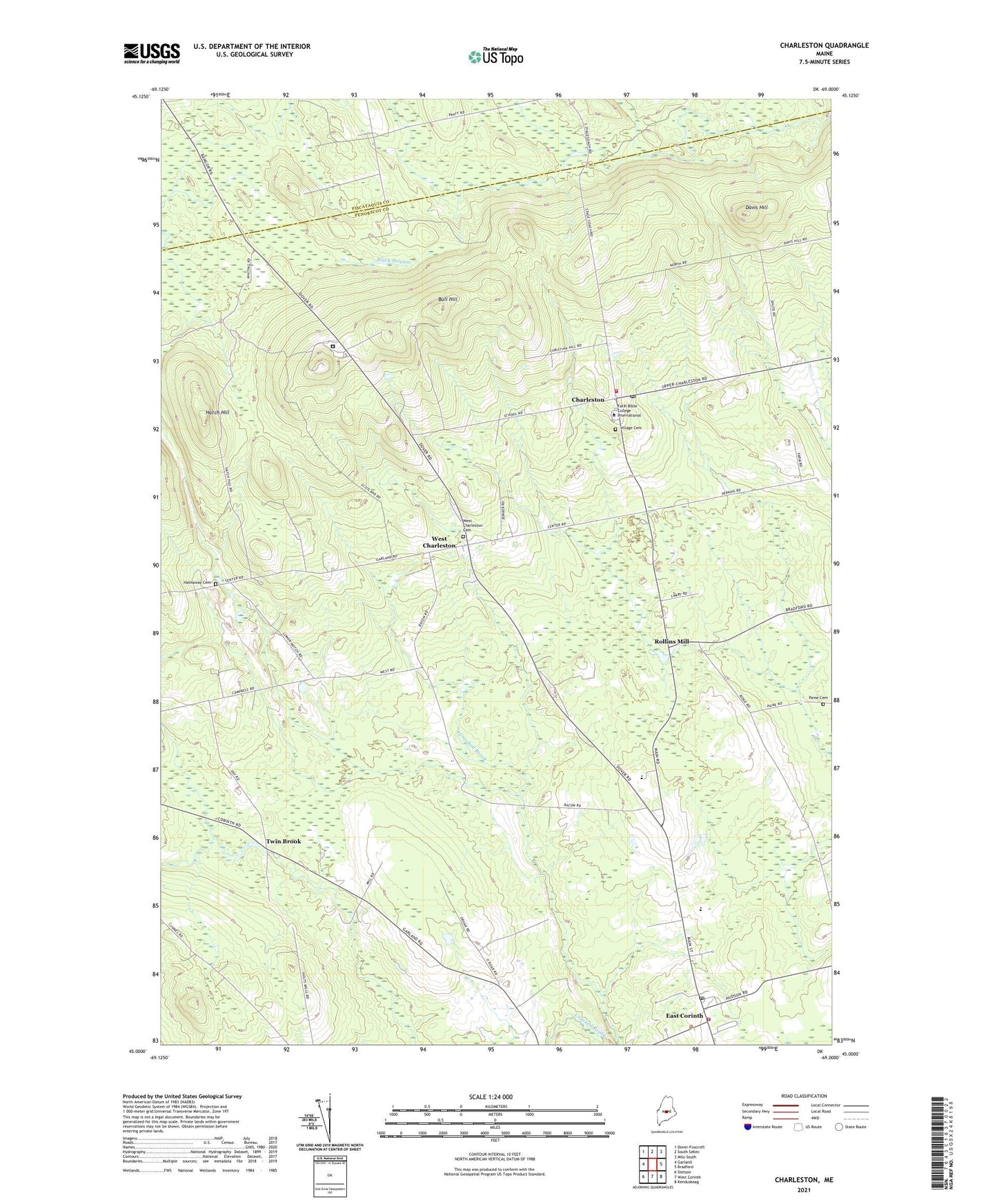
2021 topographic map quadrangle Charleston in the state of Maine. Scale: 1:24000. Based on the newly updated USGS 7.5' US Topo map series, this map is in the following counties: Penobscot, Piscataquis. The map contains contour data, water features, and other items you are used to seeing on USGS maps, but also has updated roads and other features. This is the next generation of topographic maps. Printed on high-quality waterproof paper with UV fade-resistant inks.
Quads adjacent to this one:
West: Garland
Northwest: Dover-Foxcroft
North: South Sebec
Northeast: Milo South
East: Bradford
Southeast: Kenduskeag
South: West Corinth
Southwest: Stetson
Contains the following named places: Atkins Memorial Library, Bull Hill, Burnham Brook, Charleston, Charleston Air Force Station, Charleston Correction Facility, Charleston Correctional Center Library, Charleston Elementary School, Charleston Pentecostal Church, Charleston Post Office, Charleston Public Library, Charleston Volunteer Fire Station, Church of the Open Bible, Corinth Post Office, Corinth Volunteer Fire and Rescue Department, Corinth Volunteer Rescue Service, Davis Hill, Doore School, East Corinth, Faith School of Theology, Hatch Hill, Hathaway Cemetery, Hathaway School, Hicks Corner, Higgins Classical Institute, Highview Christian Academy, Mountain View Correctional Facility, Mountain View Youth Development Center, Mountain View Youth Development Center School, Rollins Brook, Rollins Mill, South Gate Brook, Town of Charleston, Twin Brook, West Charleston, ZIP Code: 04422