MyTopo
Garland Maine US Topo Map
Couldn't load pickup availability
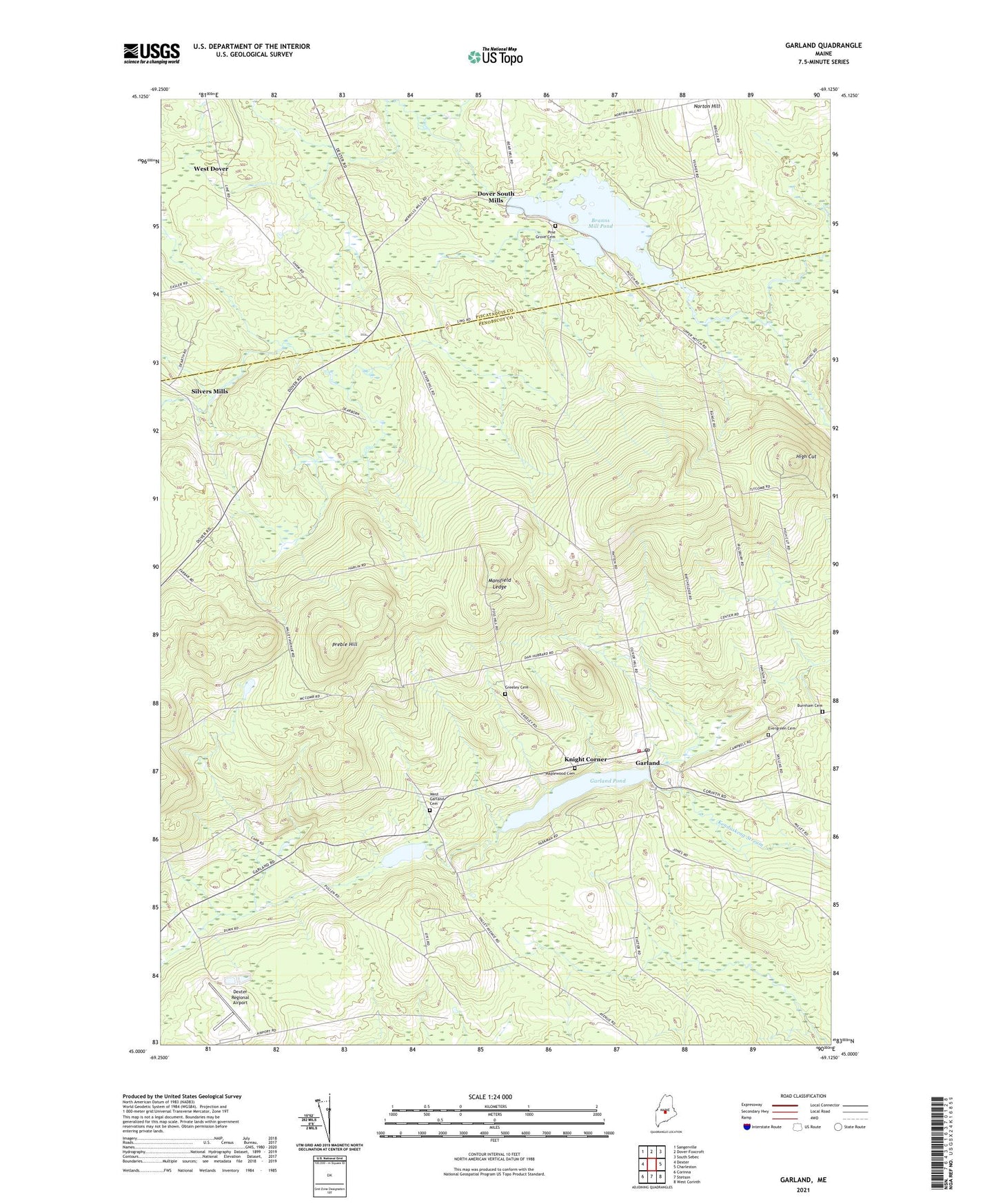
2024 topographic map quadrangle Garland in the state of Maine. Scale: 1:24000. Based on the newly updated USGS 7.5' US Topo map series, this map is in the following counties: Penobscot, Piscataquis. The map contains contour data, water features, and other items you are used to seeing on USGS maps, but also has updated roads and other features. This is the next generation of topographic maps. Printed on high-quality waterproof paper with UV fade-resistant inks.
Quads adjacent to this one:
West: Dexter
Northwest: Sangerville
North: Dover-Foxcroft
Northeast: South Sebec
East: Charleston
Southeast: West Corinth
South: Stetson
Southwest: Corinna
This map covers the same area as the classic USGS quad with code o45069a2.
Contains the following named places: Berrys Corner, Branns Mill Pond, Branns Pond Dam, Bud Leavitt Wildlife Management Area, Burnham Cemetery, Burnham School, Carr Corner, Center School, Coolidge Corner, Dexter Regional Airport, Dover South Mills, Durbin Corner, Earnest Corner, Evergreen Cemetery, Garland, Garland Elementary School, Garland Pond, Garland Pond Dam, Garland Post Office, Garland Volunteer Fire Department, Gordon Corner, Greeley Cemetery, Haseltine Corner, Haseltine School, High Cut, Knight Corner, Macomber School, Mansfield Ledge, Maplewood Cemetery, Norton Hill, Oliver Hill Corner, Pine Grove Cemetery, Preble Corner, Preble Hill, Russell Corner, Silvers Mills, South Ridge School, Town of Garland, West Dover, West Garland Cemetery, West Garland Pond, West Garland School, WGUY-FM (Dexter), WQCB-FM (Brewer), ZIP Code: 04939