MyTopo
Cross Island Maine US Topo Map
Couldn't load pickup availability
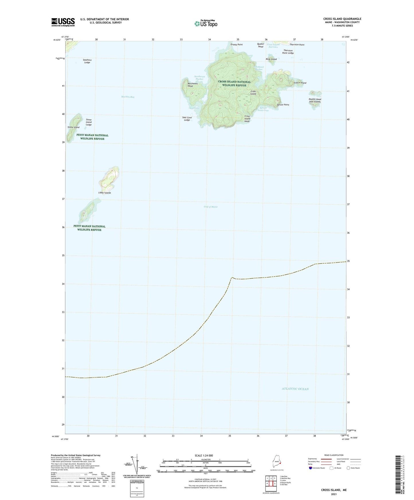
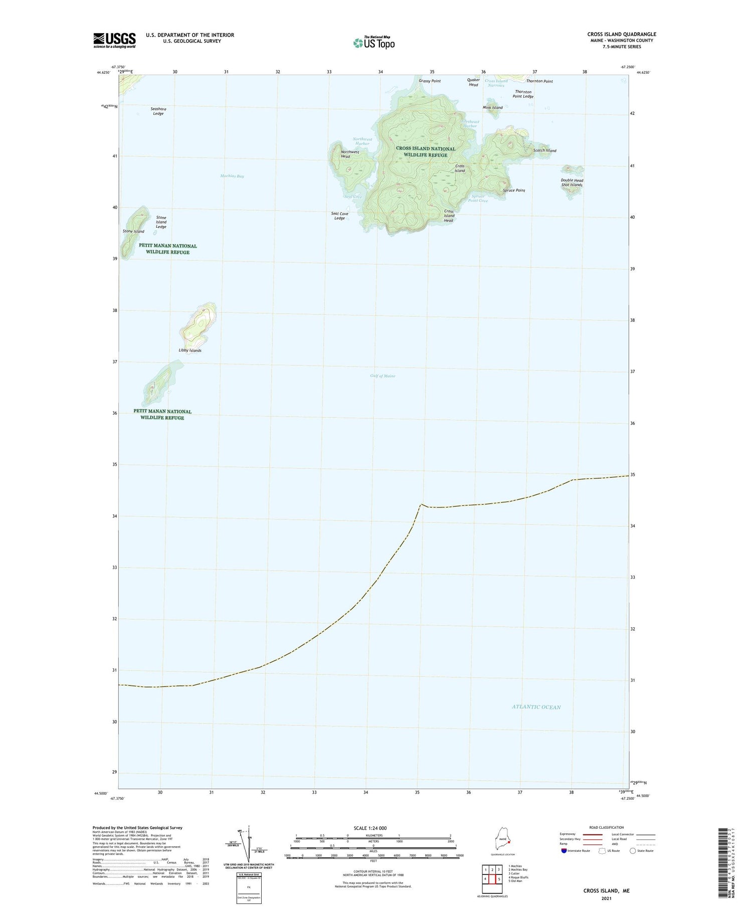
2021 topographic map quadrangle Cross Island in the state of Maine. Scale: 1:24000. Based on the newly updated USGS 7.5' US Topo map series, this map is in the following counties: Washington. The map contains contour data, water features, and other items you are used to seeing on USGS maps, but also has updated roads and other features. This is the next generation of topographic maps. Printed on high-quality waterproof paper with UV fade-resistant inks.
Quads adjacent to this one:
West: Roque Bluffs
Northwest: Machias
North: Machias Bay
Northeast: Cutler
East: Old Man
Contains the following named places: Cross Island, Cross Island Head, Cross Island Narrows, Cross Island National Wildlife Refuge, Double Head Shot Islands, Gulf of Maine, Libby Island Light Station, Libby Islands, Mink Island, Northeast Harbor, Northwest Harbor, Northwest Head, Quaker Head, Scotch Island, Seal Cove, Seal Cove Ledge, Seashore Ledge, Spruce Point, Spruce Point Cove, Stone Island, Stone Island Ledge, Thornton Point, Thornton Point Ledge