MyTopo
Machias Maine US Topo Map
Couldn't load pickup availability
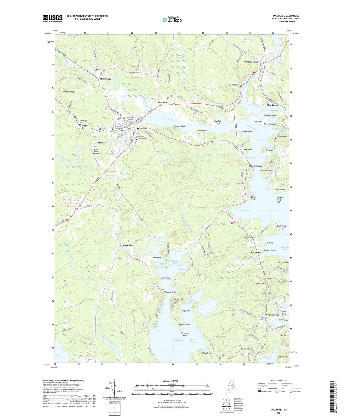
2024 topographic map quadrangle Machias in the state of Maine. Scale: 1:24000. Based on the newly updated USGS 7.5' US Topo map series, this map is in the following counties: Washington. The map contains contour data, water features, and other items you are used to seeing on USGS maps, but also has updated roads and other features. This is the next generation of topographic maps. Printed on high-quality waterproof paper with UV fade-resistant inks.
Quads adjacent to this one:
West: Whitneyville
Northwest: Bog Lake
North: Hadley Lake
Northeast: Long Lake
East: Machias Bay
Southeast: Cross Island
South: Roque Bluffs
Southwest: Jonesport
This map covers the same area as the classic USGS quad with code o44067f4.
Contains the following named places: Bad Little Falls Park, Bangor Hydro Dam, Birch Point, Bucks Harbor, Bucks Mountain, Bucks Neck, Burnham Tavern, Centre Street Congregational Church, Coastal Washington County Institute of Technology, Coastal Washington County Institute of Technology Center, Collins Branch, Court Street Cemetery, Crocker Point, Days Head, Dog Town, Down East Community Hospital, Downeast Correctional Facility, Downeast Health Services, Duck Cove, East Branch Little Kennebec Bay, East Machias, East Machias Elementary School, East Machias Historic District, East Machias Post Office, East Machias River, East Machias River Reservoir, East Machias Volunteer Fire Department, Elm Street School, Florence Sturdivant Public Library, Fort O'Brien, Fort O'Brien Point, Fort O'Brien School, Fort O'Brien State Historic Site, Foss Point, Gates House Museum, Gays Shopping Center, Hog Island, Holmes Point, Holy Name Catholic Church, Hooper Point, Hope Island, Howard Mountain, Hoyttown, Huntley Mountain, Indian Head, Jasper Beach, Johnson Point, Kennebec, Kennebec Baptist Church, L Point, Larrabee, Libby Brook, Libby Cove, Libby Head, Little Kennebec Bay, Longfellow Cemetery, Machias, Machias Census Designated Place, Machias Customs House, Machias Fire Department, Machias Memorial High School, Machias Montessori School, Machias Police Department, Machias Post Office, Machias River, Machias Town Hall, Machias Valley Airport, Machias Valley Baptist Church, Machias Valley Christian School, Machiasport, Machiasport Historical Society, Machiasport Station, Machiasport Volunteer Fire Department, Marshall Point, Marshfield, Marston Point, Meadow Brook, Meserve Head, Middle River, Middle River Dam, Middle River Reservoir, Mill Creek, Mill Pond, Miller Mountain, Moose Snare Cove, Mount Aetna, Narrows Mountain, Newcomb Point, O'Brien Cemetery, Petegrow Cove, Porcupine Island, Porter Memorial Library, Pot Head, Pumpkin Ridge, Randall Point, Randall Point Flats, Rose M Gaffney School, Runaway Pond Heath, Saint Aidans Episcopal Church, Sanborn Cove, Sanborn Marsh, Seashore Mountain, Shipyard Cove, Simpson Island, Smith Point, Spruce Cove, Stevens Cove, Stuart Ridge, Sylvan Park, The Rim, Town of Machias, Town of Machiasport, University of Maine at Machias, University of Maine Machias Merrill Library, Washington Academy, Washington County Courthouse, Washington County Jail, Washington County Law Library, Washington County Sheriff's Office, West Branch Little Kennebec Bay, WMCS-AM (Machias), Woodruff Cove, Yoho Creek, Yoho Head, ZIP Code: 04655