MyTopo
Machias Bay Maine US Topo Map
Couldn't load pickup availability
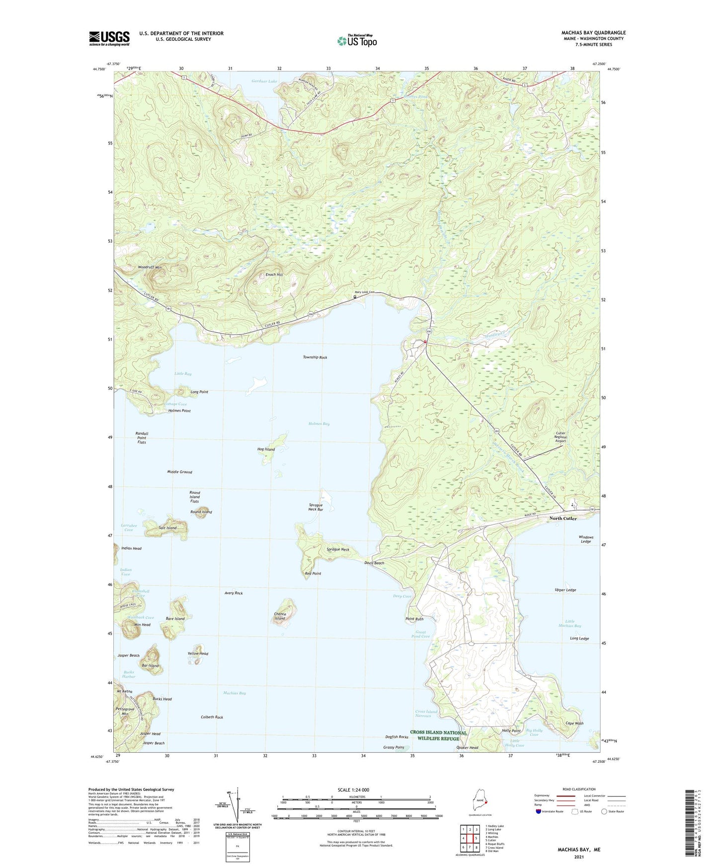
2024 topographic map quadrangle Machias Bay in the state of Maine. Scale: 1:24000. Based on the newly updated USGS 7.5' US Topo map series, this map is in the following counties: Washington. The map contains contour data, water features, and other items you are used to seeing on USGS maps, but also has updated roads and other features. This is the next generation of topographic maps. Printed on high-quality waterproof paper with UV fade-resistant inks.
Quads adjacent to this one:
West: Machias
Northwest: Hadley Lake
North: Long Lake
Northeast: Whiting
East: Cutler
Southeast: Old Man
South: Cross Island
Southwest: Roque Bluffs
This map covers the same area as the classic USGS quad with code o44067f3.
Contains the following named places: Avery Rock, Avery Rock Lighthouse, Bar Island, Bare Island, Bay Ridge Elementary School, Big Holly Cove, Bucks Harbor, Bucks Head, Cape Wash, Cape Wash Island, Chance Island, Clamshell Cove, Colbeth Rock, Cottage Cove, Cutler Navy Fire Department, Cutler Regional Airport, Davis Beach, Deep Cove, Dogfish Rocks, Enoch Hill, Grassy Point, Great Pond, Great Pond Cove, Hog Island, Holly Point, Holmes Bay, Holmes Bay Church, Holmes Bay School, Holmes Point, Holmes Pond, Holmes Stream, Huntley Creek, Indian Cove, Jasper Beach, Jasper Head, Larrabee Cove, Little Bay, Little Holly Cove, Little Machias Bay, Long Ledge, Long Point, Machias Bay, Mary Look Cemetery, Middle Ground, Mountain Head, Naval Radio Station Cutler, North Cutler, Pettegrove Mountain, Point Ruth, Randall Point Flats, Red Point, Round Island, Round Island Flats, Salt Island, Sprague Neck, Sprague Neck Bar, Township Rock, Upper Ledge, Waleback Cove, Windows Ledge, Woodruff Mountain, Yellow Head