MyTopo
Dexter Maine US Topo Map
Couldn't load pickup availability
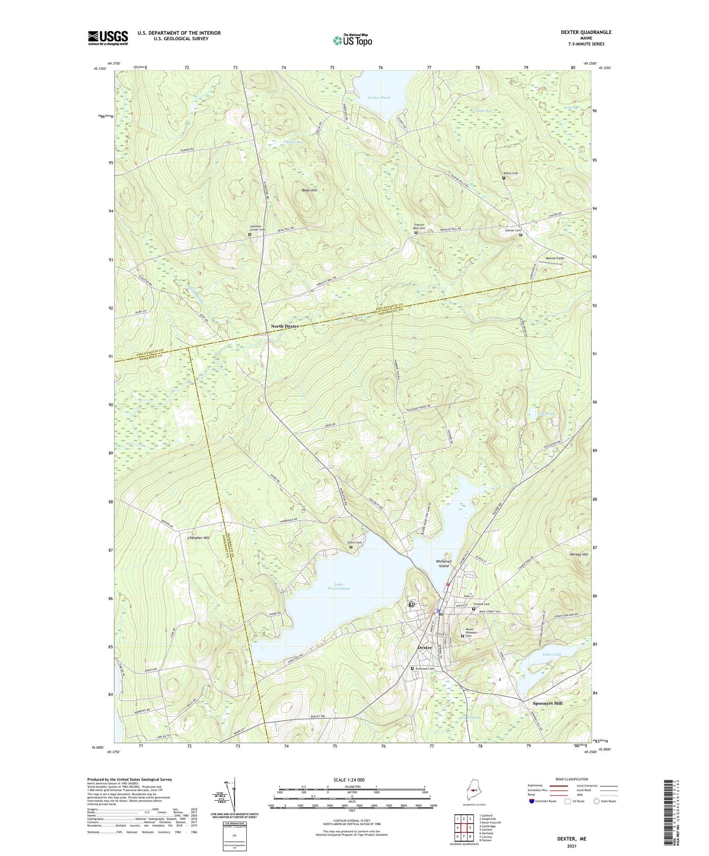
2021 topographic map quadrangle Dexter in the state of Maine. Scale: 1:24000. Based on the newly updated USGS 7.5' US Topo map series, this map is in the following counties: Penobscot, Piscataquis, Somerset. The map contains contour data, water features, and other items you are used to seeing on USGS maps, but also has updated roads and other features. This is the next generation of topographic maps. Printed on high-quality waterproof paper with UV fade-resistant inks.
Quads adjacent to this one:
West: Cambridge
Northwest: Guilford
North: Sangerville
Northeast: Dover-Foxcroft
East: Garland
Southeast: Stetson
South: Corinna
Southwest: Hartland
Contains the following named places: Abbot Memorial Library, Alder Brook, Bailey Cemetery, Bean Hill, Brown Bog, Center Pond, Chandler Hill, Dexter, Dexter Ambulance Service, Dexter Census Designated Place, Dexter Christian Academy, Dexter Fire Department, Dexter Historical Society Museum, Dexter Middle School, Dexter Municipal Golf Course, Dexter Police Department, Dexter Post Office, Dexter Primary School, Dexter Regional High School, Dexter Universalist Church, Echo Lake, Fay Scott Bog, French Mills Brook, Frenchs Mills Cemetery, Gilman Cemetery, Gilman Corner, Goff Brook, Grey Bog, Hersey Hill, Jackman Corner, Jackman Corner Cemetery, Jackman Corner School, Lake Wassookeag, Lily Pond, Lougee Bog, Morrel Field, Mount Pleasant Cemetery, North Dexter, Puffers Pond Dam, Ridge View Community School, Snow Brook, Spooners Mill, Storer Cemetery, Town of Dexter, Tri County Technical Center School, Tri-County Regional Technical Center, Wassookeag Camp, Wassookeag Lake Dam, Wilderness Community Church, Witherell Island, ZIP Codes: 04479, 04930