MyTopo
Sangerville Maine US Topo Map
Couldn't load pickup availability
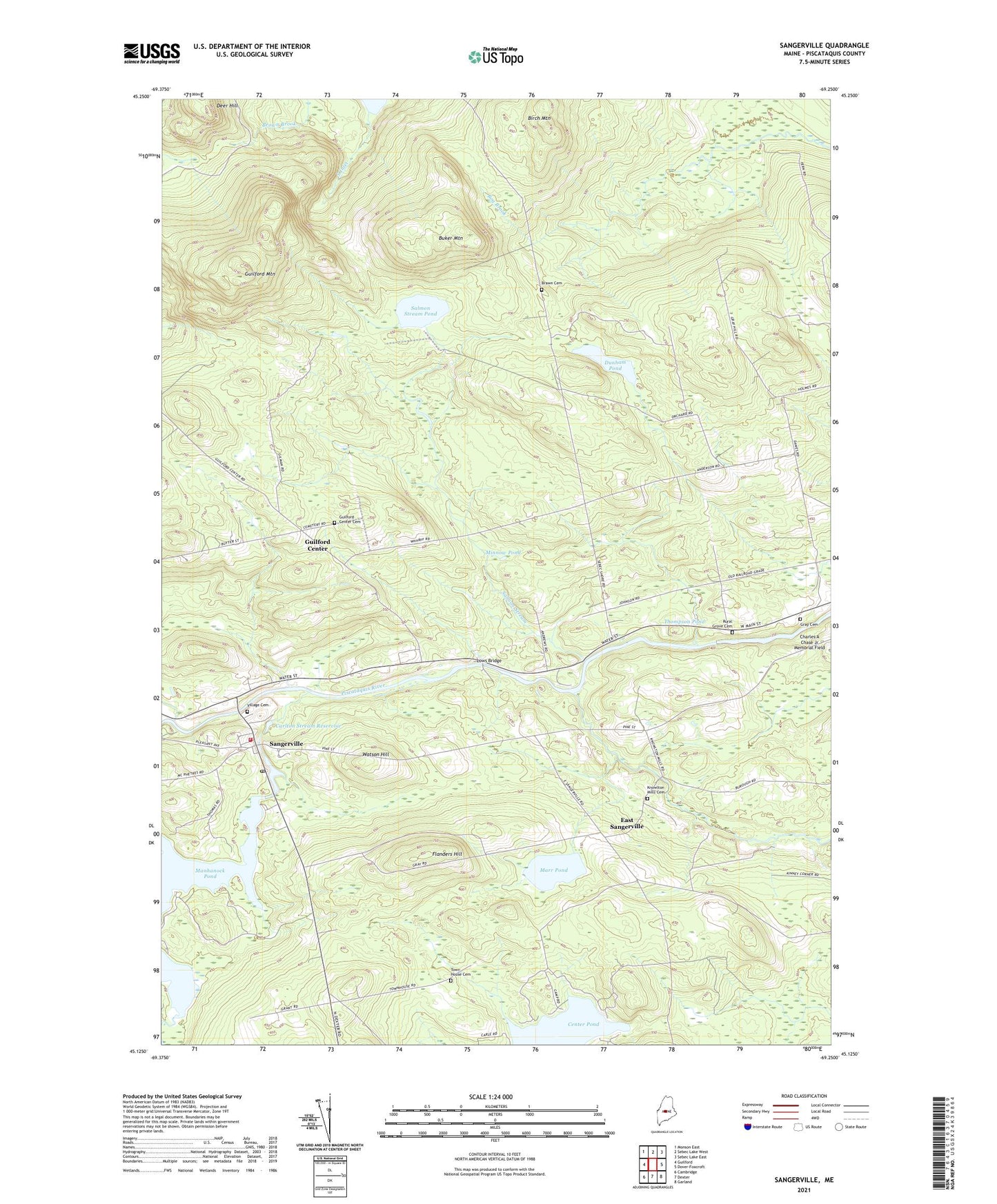
2024 topographic map quadrangle Sangerville in the state of Maine. Scale: 1:24000. Based on the newly updated USGS 7.5' US Topo map series, this map is in the following counties: Piscataquis. The map contains contour data, water features, and other items you are used to seeing on USGS maps, but also has updated roads and other features. This is the next generation of topographic maps. Printed on high-quality waterproof paper with UV fade-resistant inks.
Quads adjacent to this one:
West: Guilford
Northwest: Monson East
North: Sebec Lake West
Northeast: Sebec Lake East
East: Dover-Foxcroft
Southeast: Garland
South: Dexter
Southwest: Cambridge
This map covers the same area as the classic USGS quad with code o45069b3.
Contains the following named places: Abbie Fowler School, Birch Mountain, Black Stream, Brawn Cemetery, Brown Brook, Brown School, Buker Mountain, Campbell Corner School, Carlton Stream, Carlton Stream Dam, Carlton Stream Reservoir, Dover-Foxcroft Plaza Shopping Center, Dunham Corner, Dunham Pond, East Sangerville, First Unitarian Universalist Church of Sangerville, Flanders Brook, Flanders Hill, Gray Cemetery, Guilford Center, Guilford Center Baptist Church, Guilford Center Cemetery, Guilford Mountain, Howard Corner, Jackson Corner School, Knowlton Mills Cemetery, Lows Bridge, Manhanock Pond Dam, Marr Pond, Maxfield Brook, Merrill Brook, Minnow Pond, Oak Brook, Old Blacksmith Shop Museum, Piscataquis Country Club, Rural Grove Cemetery, Salmon Stream, Salmon Stream Pond, Sangerville, Sangerville Post Office, Sangerville Public Library, Sangerville Volunteer Fire Department, Schoolhouse Brook, South Inlet, Sucker Brook, Thompson Pond, Town House Cemetery, Town of Guilford, Town of Sangerville, Townhouse Brook, Village Cemetery, Watson Hill, ZIP Code: 04443