MyTopo
East Dixfield Maine US Topo Map
Couldn't load pickup availability
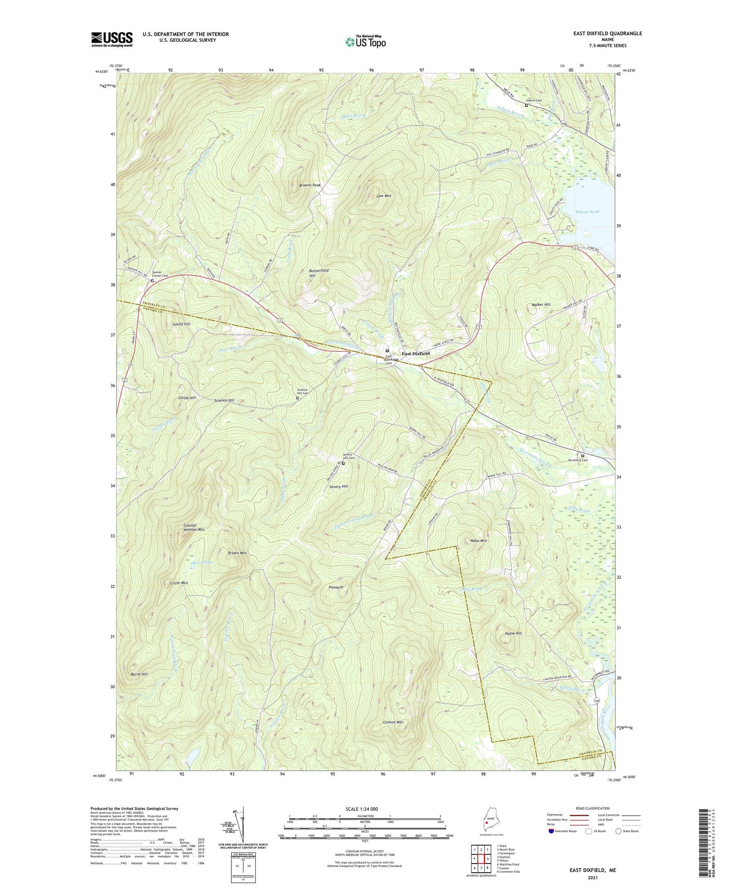
2021 topographic map quadrangle East Dixfield in the state of Maine. Scale: 1:24000. Based on the newly updated USGS 7.5' US Topo map series, this map is in the following counties: Franklin, Oxford. The map contains contour data, water features, and other items you are used to seeing on USGS maps, but also has updated roads and other features. This is the next generation of topographic maps. Printed on high-quality waterproof paper with UV fade-resistant inks.
Quads adjacent to this one:
West: Dixfield
Northwest: Weld
North: Mount Blue
Northeast: Farmington
East: Wilton
Southeast: Livermore Falls
South: Canton
Southwest: Worthley Pond
Contains the following named places: Adams Cemetery, Allen Brook, Bates Brook, Beaver Pond, Birchland Cemetery, Brown Mountain, Browns Peak, Burnt Hill, Butterfield Brook, Butterfield Hill, Canton Mountain, Childs Hill, Colonel Holman Mountain, Cram Brook, Dean Brook, East Dixfield, East Dixfield Cemetery, East Dixfield Post Office, Fletcher Brook, Gould Hill, Hugh Brook, Jolly Brook, Law Mountain, Little Mountain, Nebo Mountain, Paine Hill, Pine Brook, Pinnacle, Potash Brook, Ridley Brook, Science Hill, Science Hill Cemetery, Sevenmile Stream, Severy Hill, Severy Hill Cemetery, Tainter Corner, Tainter Corner Cemetery, Tucker Valley Brook, Walker Hill, Wilson Pond, Wilson Stream, ZIP Code: 04227