MyTopo
Farrar Mountain Maine US Topo Map
Couldn't load pickup availability
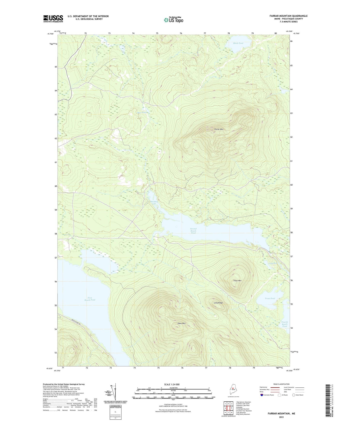
2021 topographic map quadrangle Farrar Mountain in the state of Maine. Scale: 1:24000. Based on the newly updated USGS 7.5' US Topo map series, this map is in the following counties: Piscataquis. The map contains contour data, water features, and other items you are used to seeing on USGS maps, but also has updated roads and other features. This is the next generation of topographic maps. Printed on high-quality waterproof paper with UV fade-resistant inks.
Quads adjacent to this one:
West: Kokadjo
Northwest: Big Spencer Mountain
North: Caribou Lake South
Northeast: Rainbow Lake West
East: Wadleigh Mountain
Southeast: Big Shanty Mountain
South: Hay Mountain
Southwest: Number Four Mountain
Contains the following named places: Bear Pond, Black Pond, Farrar Mountain, Hinckley Brook, Hinckley Cove, Long Bog, Long Ridge, Medawisla, North Inlet, Rowell Brook, Second Roach Pond, Second Roach Pond Dam, Shaw Mountain, Shawtown Township, T1 R12 WELS, Trout Mountain, Trout Pond