MyTopo
Hay Mountain Maine US Topo Map
Couldn't load pickup availability
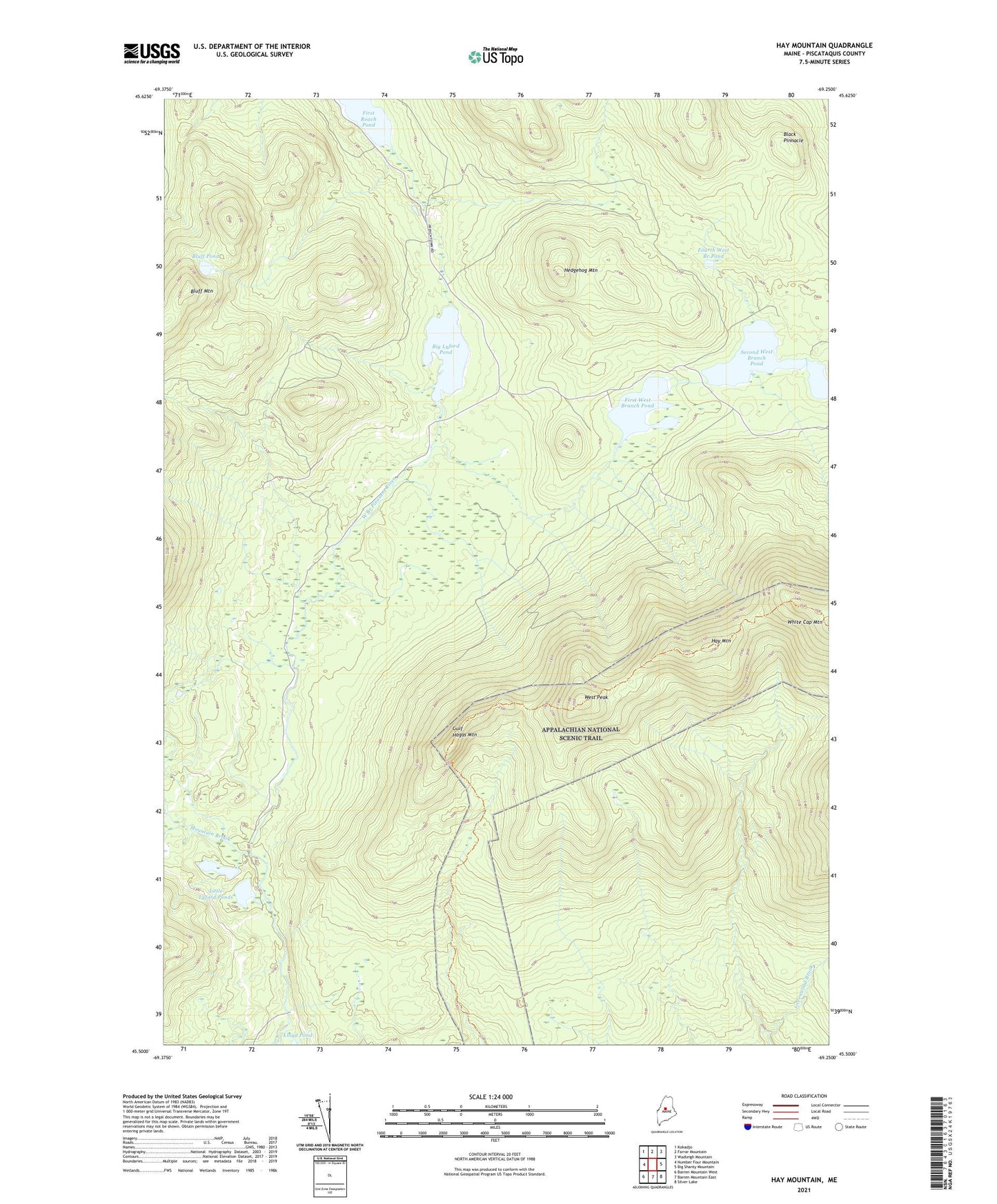
2024 topographic map quadrangle Hay Mountain in the state of Maine. Scale: 1:24000. Based on the newly updated USGS 7.5' US Topo map series, this map is in the following counties: Piscataquis. The map contains contour data, water features, and other items you are used to seeing on USGS maps, but also has updated roads and other features. This is the next generation of topographic maps. Printed on high-quality waterproof paper with UV fade-resistant inks.
Quads adjacent to this one:
West: Number Four Mountain
Northwest: Kokadjo
North: Farrar Mountain
Northeast: Wadleigh Mountain
East: Big Shanty Mountain
Southeast: Silver Lake
South: Barren Mountain East
Southwest: Barren Mountain West
This map covers the same area as the classic USGS quad with code o45069e3.
Contains the following named places: Baker Mountain Brook, Big Lyford Pond, Black Pinnacle, Bluff Mountain, Bluff Pond, Bowdoin College Grant East Township, Duran Brook, First West Branch Pond, Fourth West Branch Pond, Greenwood Brook, Gulf Hagas Mountain, Hay Mountain, Hedgehog Mountain, Inlet Brook, Little Lyford Pond Camps, Little Lyford Ponds, Lloyd Pond, Mountain Brook, Second West Branch Pond, Slaughter Brook, Third West Branch Pond, West Peak