MyTopo
Number Four Mountain Maine US Topo Map
Couldn't load pickup availability
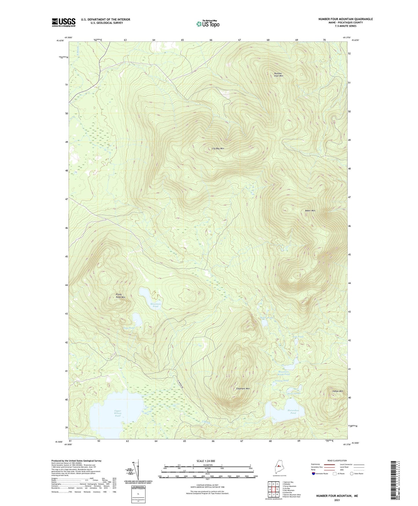
2024 topographic map quadrangle Number Four Mountain in the state of Maine. Scale: 1:24000. Based on the newly updated USGS 7.5' US Topo map series, this map is in the following counties: Piscataquis. The map contains contour data, water features, and other items you are used to seeing on USGS maps, but also has updated roads and other features. This is the next generation of topographic maps. Printed on high-quality waterproof paper with UV fade-resistant inks.
Quads adjacent to this one:
West: Lily Bay
Northwest: Spencer Bay
North: Kokadjo
Northeast: Farrar Mountain
East: Hay Mountain
Southeast: Barren Mountain East
South: Barren Mountain West
Southwest: Greenville
This map covers the same area as the classic USGS quad with code o45069e4.
Contains the following named places: Baker Brook, Baker Mountain, Baker Pond, Bowdoin College Grant West Township, Elephant Mountain, Fogg Pond, Grassy Pond, Horseshoe Pond, Indian Mountain, Lily Bay Mountain, Lost Pond, Meadow Brook, Mountain Brook Pond, Mountain Pond, North Brook, Number Four Mountain, Pearl Ponds, Prong Pond Mountain, South Brook, Town of Beaver Cove, Upper Wilson Pond