MyTopo
Hurricane Pond Maine US Topo Map
Couldn't load pickup availability
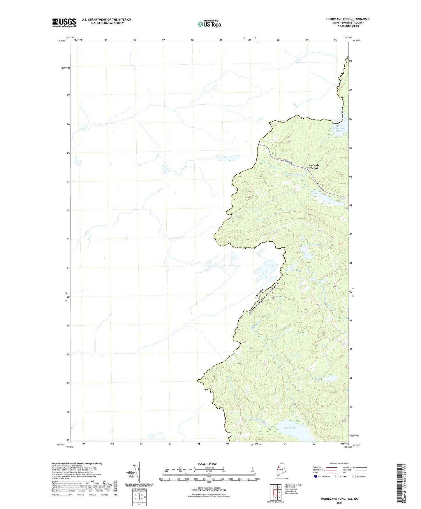
2024 topographic map quadrangle Hurricane Pond in the state of Maine. Scale: 1:24000. Based on the newly updated USGS 7.5' US Topo map series, this map is in the following counties: Somerset. The map contains contour data, water features, and other items you are used to seeing on USGS maps, but also has updated roads and other features. This is the next generation of topographic maps. Printed on high-quality waterproof paper with UV fade-resistant inks.
Quads adjacent to this one:
North: Saint Zacharie North
Northeast: Black Brook
East: Hurricane Hill
Southeast: Penobscot Lake
South: Fisher Ponds
This map covers the same area as the classic USGS quad with code o46070a3.
Contains the following named places: Boundary Cottage, Clish Pond, Fish Brook, Frost Pond, Frost Pond Brook, Hurricane Pond, Hurricane Pond Dam, La Croix Depot, Line Pond, Little Saint John Lake, Parkers Pond, Roberts Pond, T5 R20 WELS