MyTopo
Kenduskeag Maine US Topo Map
Couldn't load pickup availability
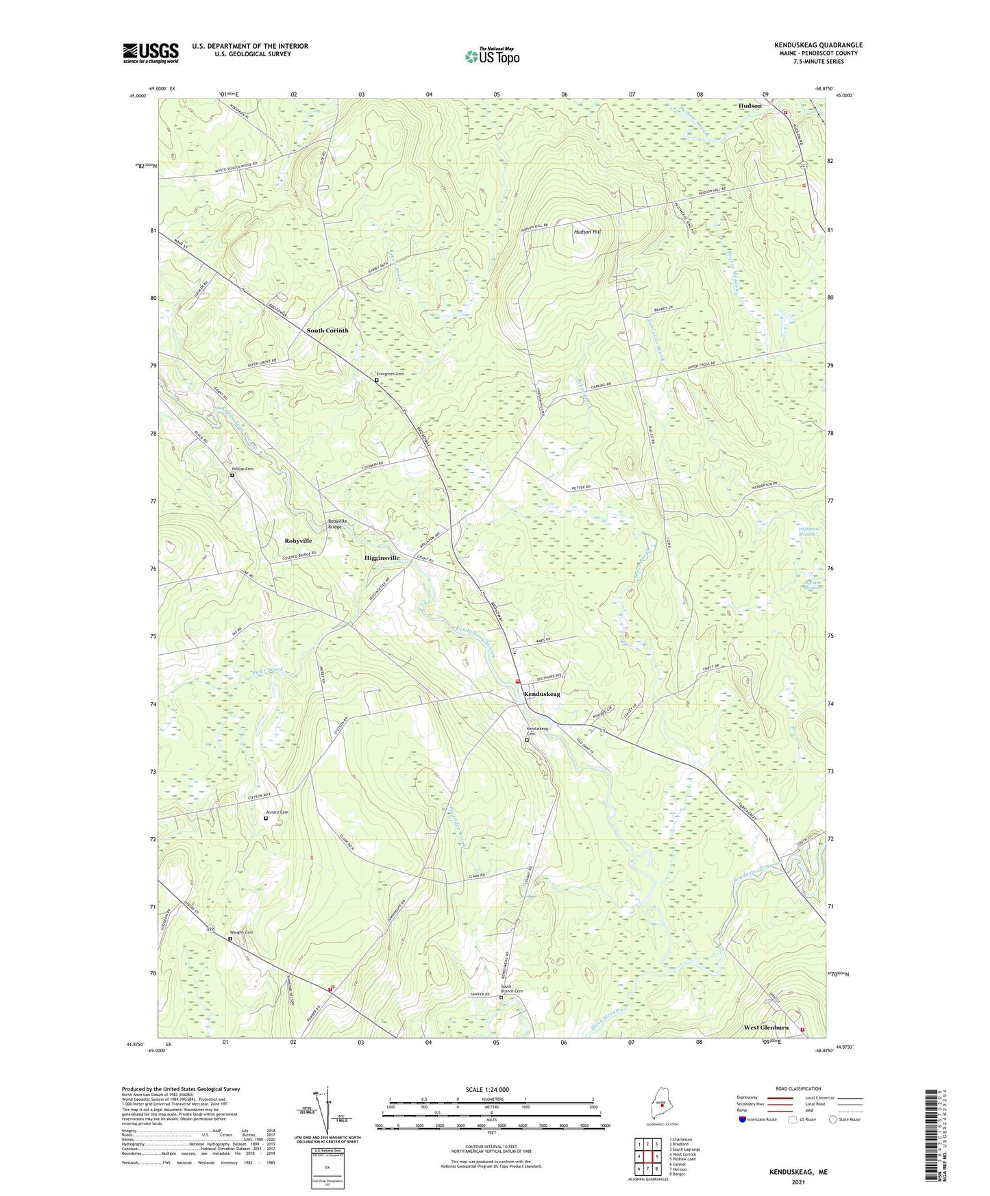
2021 topographic map quadrangle Kenduskeag in the state of Maine. Scale: 1:24000. Based on the newly updated USGS 7.5' US Topo map series, this map is in the following counties: Penobscot. The map contains contour data, water features, and other items you are used to seeing on USGS maps, but also has updated roads and other features. This is the next generation of topographic maps. Printed on high-quality waterproof paper with UV fade-resistant inks.
Quads adjacent to this one:
West: West Corinth
Northwest: Charleston
North: Bradford
Northeast: South Lagrange
East: Pushaw Lake
Southeast: Bangor
South: Hermon
Southwest: Carmel
Contains the following named places: Baker Brook, Beaver Meadow, Black Stream, Case Memorial Library, Evergreen Cemetery, Glenburn Fire Department Station 23, Halfmoon Meadow, Higginsville, Hilltop Cemetery, Hudson Elementary School, Hudson Hill, Hudson Volunteer Fire Department, Kenduskeag, Kenduskeag Cemetery, Kenduskeag Elementary School, Kenduskeag Post Office, Kenduskeag Volunteer Fire Department, Levant Fire and Rescue Department, Partridge Brook, Penobscot Valley Church of Christ, Piper Brook, Robbins Field, Robyville, Robyville Bridge, South Corinth, Town of Hudson, Town of Kenduskeag, Town of Levant, Waughn Cemetery, West Glenburn, ZIP Codes: 04449, 04450, 04456