MyTopo
Kingfield Maine US Topo Map
Couldn't load pickup availability
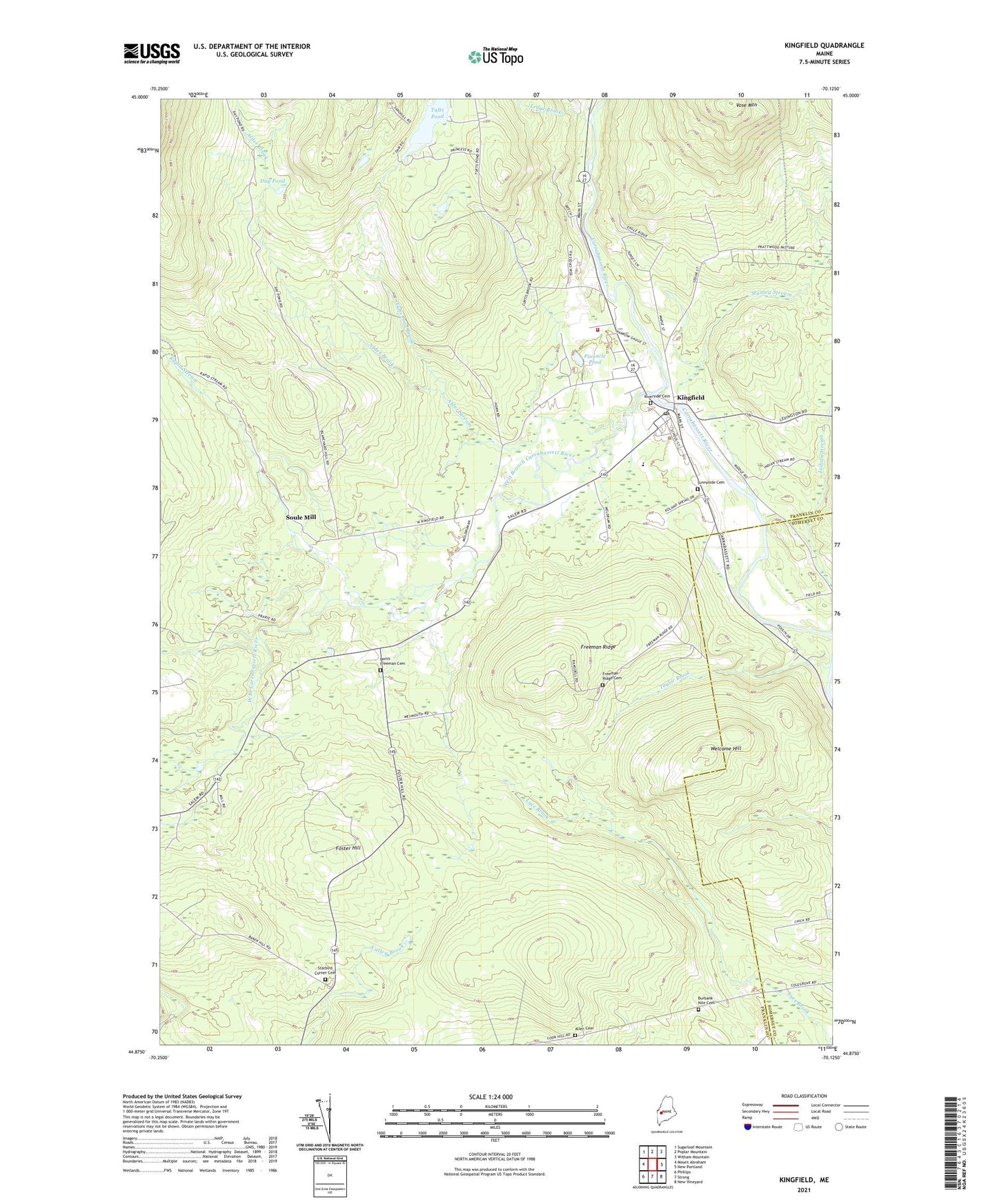
2021 topographic map quadrangle Kingfield in the state of Maine. Scale: 1:24000. Based on the newly updated USGS 7.5' US Topo map series, this map is in the following counties: Franklin, Somerset. The map contains contour data, water features, and other items you are used to seeing on USGS maps, but also has updated roads and other features. This is the next generation of topographic maps. Printed on high-quality waterproof paper with UV fade-resistant inks.
Quads adjacent to this one:
West: Mount Abraham
Northwest: Sugarloaf Mountain
North: Poplar Mountain
Northeast: Witham Mountain
East: New Portland
Southeast: New Vineyard
South: Strong
Southwest: Phillips
Contains the following named places: Alder Brook, Alder Stream, Allen Cemetery, Burbank Nile Cemetery, Carrabassett River Reservoir, Day Pond, Deer Farms Camp and Campground, First Baptist Church, Foster Hill, Freeman Ridge, Freeman Ridge Cemetery, Freeman Ridge School, Kingfield, Kingfield Census Designated Place, Kingfield Dam, Kingfield Elementary School, Kingfield Fire Department, Kingfield Historical House, Kingfield Historical Society, Kingfield Post Office, Ledge Brook, North Freeman Cemetery, North Freeman School, Pinnacle Pond, Rapid Stream, Riverside Cemetery, Soule Mill, Stanley Museum, Stanley School, Stanley Stream, Starbird Corner Cemetery, Starbird School, Sunnyside Cemetery, Taylor Brook, Town of Kingfield, Tufts Pond, Tufts Pond Brook, Vose Mountain, Webster Free Library, Welcome Hill, West Branch Carrabassett River