MyTopo
Mount Abraham Maine US Topo Map
Couldn't load pickup availability
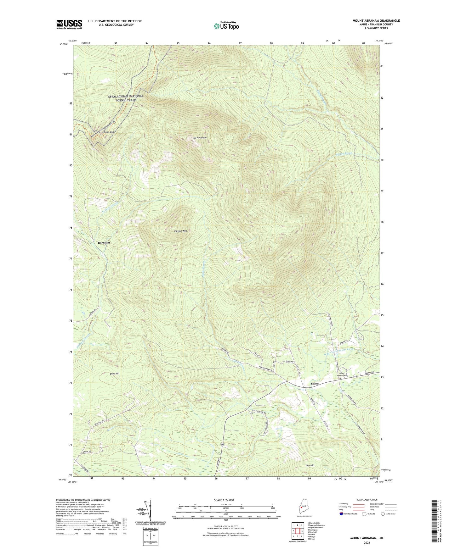
2024 topographic map quadrangle Mount Abraham in the state of Maine. Scale: 1:24000. Based on the newly updated USGS 7.5' US Topo map series, this map is in the following counties: Franklin. The map contains contour data, water features, and other items you are used to seeing on USGS maps, but also has updated roads and other features. This is the next generation of topographic maps. Printed on high-quality waterproof paper with UV fade-resistant inks.
Quads adjacent to this one:
West: Redington
Northwest: Black Nubble
North: Sugarloaf Mountain
Northeast: Poplar Mountain
East: Kingfield
Southeast: Strong
South: Phillips
Southwest: Madrid
This map covers the same area as the classic USGS quad with code o44070h3.
Contains the following named places: Barnjum, Black Nubble, Blethen School, Bray Hill, Farmer Mountain, Lone Mountain, Mount Abraham, Mount Abram Cemetery, Mount Abram Regional High School, Mount Abram Township, Norton Brook, Quick Stream, Salem, Salem Township, Unorganized Territory of East Central Franklin, ZIP Code: 04983