MyTopo
New Portland Maine US Topo Map
Couldn't load pickup availability
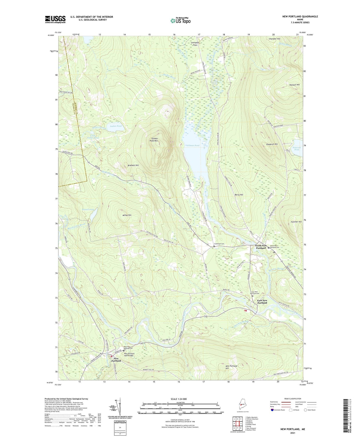
2024 topographic map quadrangle New Portland in the state of Maine. Scale: 1:24000. Based on the newly updated USGS 7.5' US Topo map series, this map is in the following counties: Somerset, Franklin. The map contains contour data, water features, and other items you are used to seeing on USGS maps, but also has updated roads and other features. This is the next generation of topographic maps. Printed on high-quality waterproof paper with UV fade-resistant inks.
Quads adjacent to this one:
West: Kingfield
Northwest: Poplar Mountain
North: Witham Mountain
Northeast: Bingham
East: Embden Pond
Southeast: Madison West
South: New Vineyard
Southwest: Strong
This map covers the same area as the classic USGS quad with code o44070h1.
Contains the following named places: Alder Brook, Berry Hill, Bloodsucker Brook, Brackett Hill, Center School, Central Elementary School, Clarks Brook, Dirigo Dowel Dam, Dyer Brook, East New Portland, East New Portland Cemetery, Fletcher Hill, Gilman Pond, Gilman Pond Mountain, Gilman Stream, Gilman Stream Dam, Gilman Stream Reservoir, Goodrich Hill, Greenleaf Cemetery, Hackett Hill, Happy Horseshoe Campground, Harris Brook, Healey Brook, Hogans Field, Indian Pond, Indian Stream, Lemon Stream, Lexington, Lexington Flats, Little Alder Brook, Little Indian Pond, Meadow Brook, Millay Hill, Millay School, New Portland, New Portland Community Library, New Portland Fire Department, New Portland Hill, New Portland Post Office, New Portland Wire Bridge, Newell Brook, North New Portland, North New Portland Cemetery, Parsons School, Pennell Pond, Pennell Pond Dam, Red School, Sandy Stream, Sucker Brook, Town of New Portland, West New Portland Cemetery