MyTopo
Meddybemps Lake East Maine US Topo Map
Couldn't load pickup availability
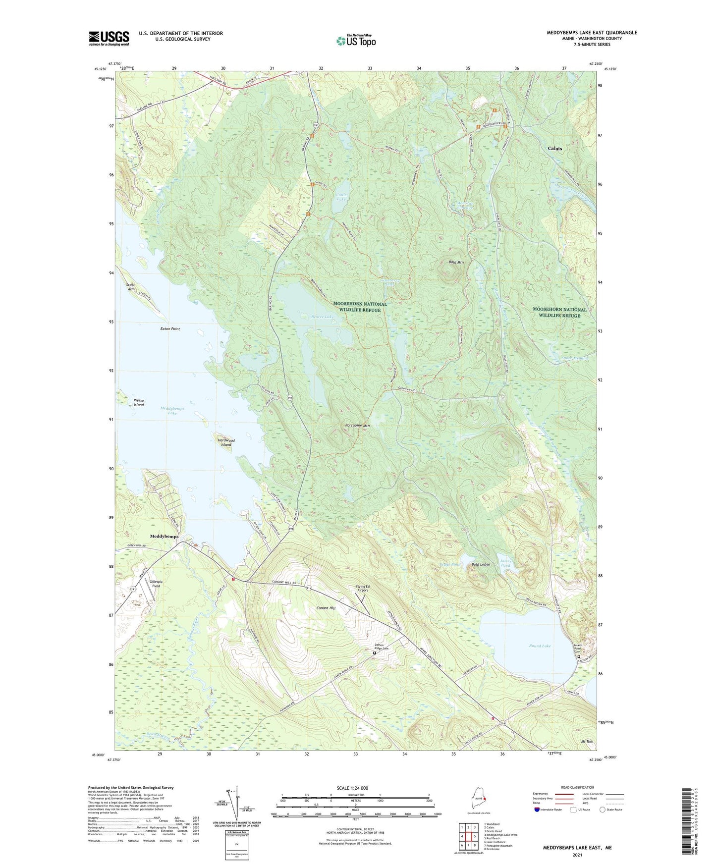
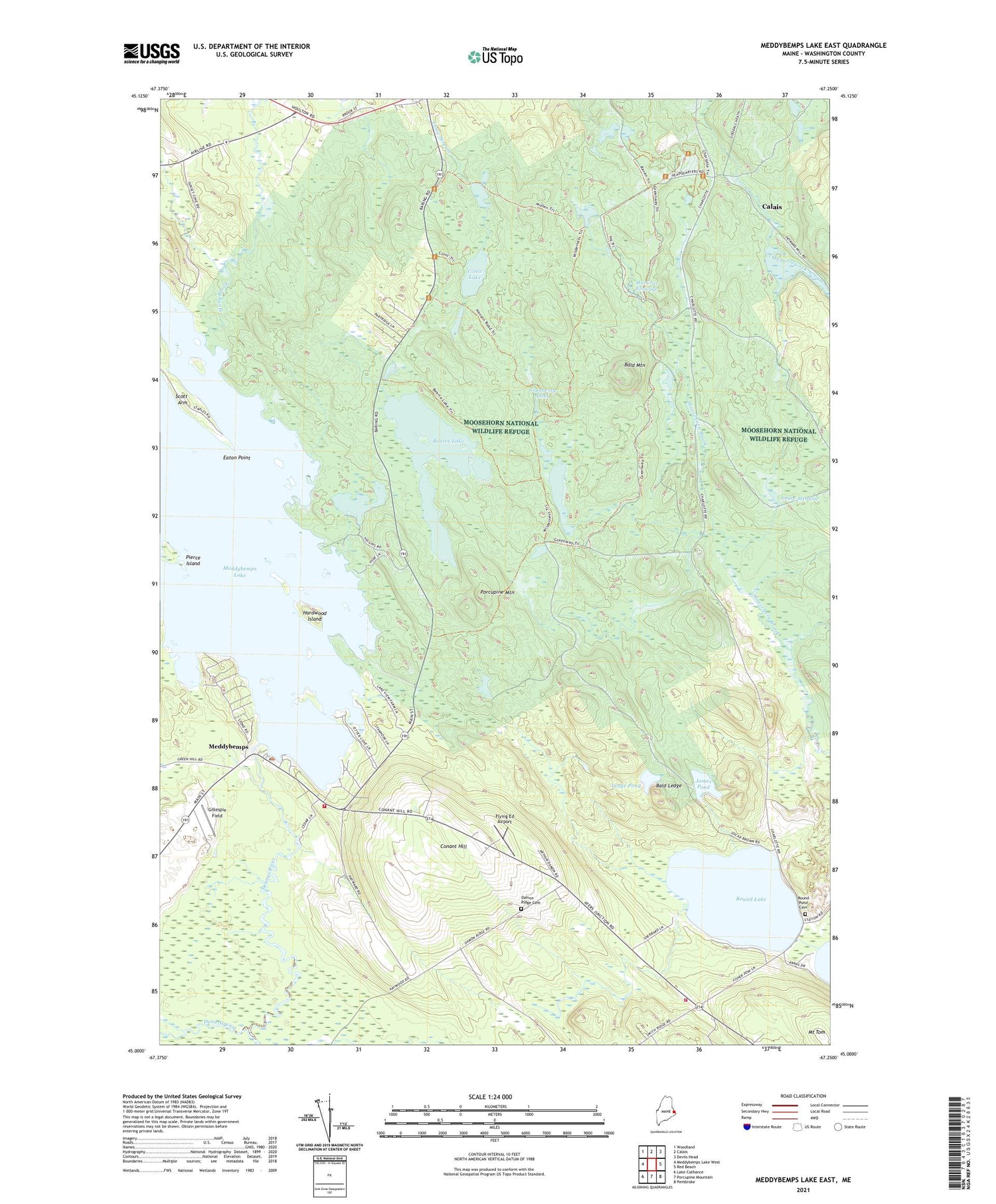
2021 topographic map quadrangle Meddybemps Lake East in the state of Maine. Scale: 1:24000. Based on the newly updated USGS 7.5' US Topo map series, this map is in the following counties: Washington. The map contains contour data, water features, and other items you are used to seeing on USGS maps, but also has updated roads and other features. This is the next generation of topographic maps. Printed on high-quality waterproof paper with UV fade-resistant inks.
Quads adjacent to this one:
West: Meddybemps Lake West
Northwest: Woodland
North: Calais
Northeast: Devils Head
East: Red Beach
Southeast: Pembroke
South: Porcupine Mountain
Southwest: Lake Cathance
Contains the following named places: Bald Ledge, Bald Mountain, Bearce Flowage, Bearce Flowage Dam, Bearce Lake, Blanchard Corner, Charlotte Volunteer Fire and Rescue Department, Conant Hill, Conic Flowage, Conic Flowage Dam, Conic Lake, Cranberry Inlet, Cranberry Inlet Dam, Cranberry Lake Dam, Cranberry Pond, Damon Ridge Cemetery, Damon School, Dead Stream, Eaton Point, Flying Ed Airport, Gillespie Field, Hardwood Island, Howard Mill Flowage, Howard Mill Flowage Dam, James Pond, Ledge Pond, MacCrae Flowage, MacCrae Flowage Dam, Meddybemps, Meddybemps Lake Canal Dam, Meddybemps Lake Dam and Fishway, Meddybemps Post Office, Meddybemps Volunteer Fire Department, Moosehorn National Wildlife Refuge, Moosehorn Wilderness (Baring Unit), Mount Tom, Pierce Island, Plantation of Baring, Porcupine Mountain, Rocky Meadow Brook, Round Lake, Round Pond Cemetery, Scott Arm, Smith Power House Dam, Snare Meadow, Snare Meadow Dam, Stone Camp, Town of Charlotte, Town of Meddybemps, Tyler Flowage, Tyler Flowage Dam, Upper Goodall Heath Dam, Upper Pond, WMED-FM (Calais), WMED-TV (Calais), Young Siding