MyTopo
Red Beach Maine US Topo Map
Couldn't load pickup availability
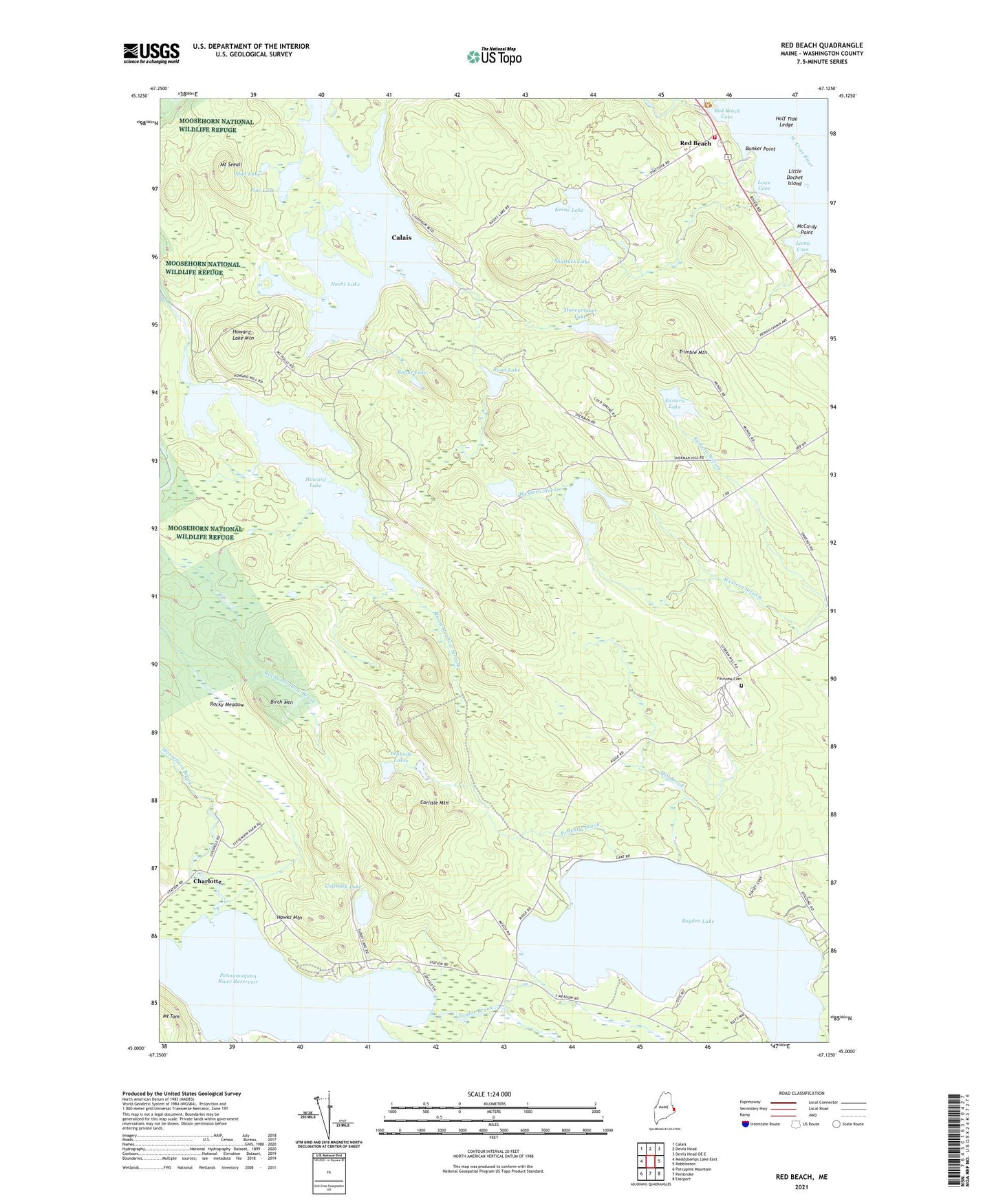
2024 topographic map quadrangle Red Beach in the state of Maine. Scale: 1:24000. Based on the newly updated USGS 7.5' US Topo map series, this map is in the following counties: Washington. The map contains contour data, water features, and other items you are used to seeing on USGS maps, but also has updated roads and other features. This is the next generation of topographic maps. Printed on high-quality waterproof paper with UV fade-resistant inks.
Quads adjacent to this one:
West: Meddybemps Lake East
Northwest: Calais
North: Devils Head
Northeast: Devils Head OE E
East: Robbinston
Southeast: Eastport
South: Pembroke
Southwest: Porcupine Mountain
This map covers the same area as the classic USGS quad with code o45067a2.
Contains the following named places: Beaver Brook, Birch Mountain, Boyden Lake, Bunker Point, Calais Fire Department Station 2, Carlisle Mountain, Charlotte, Coleback Lake, Dead Meadow Stream, Eastern Lake, Eastern Stream, Fairview Cemetery, Goulding Lake, Half Tide Ledge, Hawks Mountain, Hilltop Campground, Howard Lake, Howard Lake Mountain, Keene Lake, Keenes Lake Campground, Lamb Cove, Little Dochet Island, Lowe Cove, Magurrewock Lakes, McCurdy Point, Mill Brook, Moneymaker Lake, Moosehorn Brook, Mount Seeall, Mud Lake, Nashs Lake, Ohio Brook, Penknife Brook, Penknife Lakes, Pennamaquan River Reservoir, Pine Lake, Rand Lake, Red Beach, Red Beach Cove, Robbinston Ridge Church, Rocky Meadow, Rogue Lake, Shattuck Lake, South Robbinston Ridge School, Taylor Brook, Town of Robbinston, Trimble Mountain, Western Lake, ZIP Code: 04671