MyTopo
Devils Head Maine US Topo Map
Couldn't load pickup availability
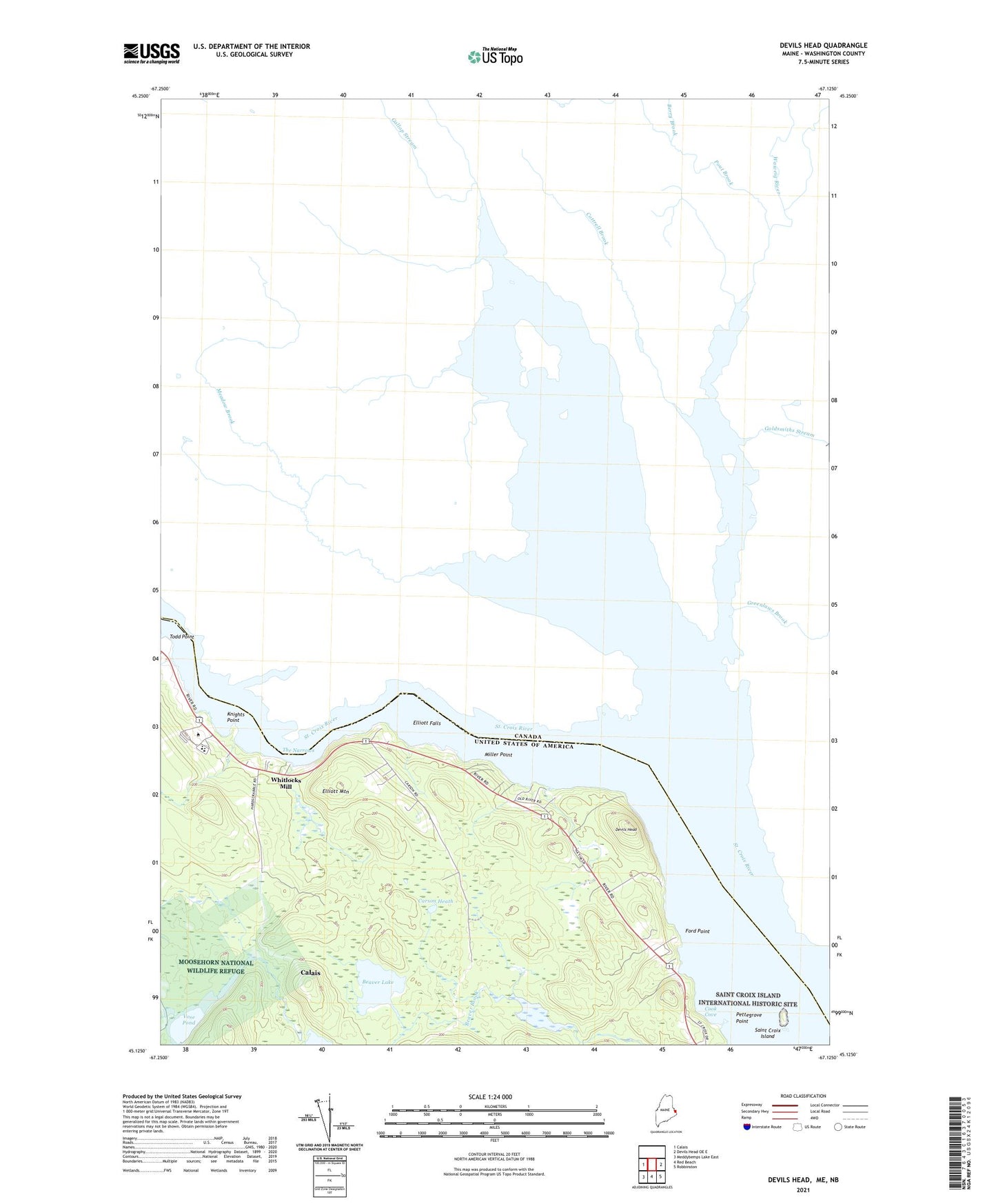
2024 topographic map quadrangle Devils Head in the state of Maine. Scale: 1:24000. Based on the newly updated USGS 7.5' US Topo map series, this map is in the following counties: Washington. The map contains contour data, water features, and other items you are used to seeing on USGS maps, but also has updated roads and other features. This is the next generation of topographic maps. Printed on high-quality waterproof paper with UV fade-resistant inks.
Quads adjacent to this one:
West: Calais
East: Devils Head OE E
Southeast: Robbinston
South: Red Beach
Southwest: Meddybemps Lake East
This map covers the same area as the classic USGS quad with code o45067b2.
Contains the following named places: Beaver Lake, Calais Schools, Carson Heath, City of Calais, Cook Cove, Devils Head, Elliott Falls, Elliott Mountain, Flowed Land Ponds, Ford Point, Knights Point, Miller Point, Nash Lake, Nash Lake Dam, Pettegrove Point, Saint Croix Island, Saint Croix Island International Historic Site, Saint Croix Regional Technical Center School, The Narrows, Todd Point, Vose Pond, Vose Pond Dam, Washington County Community College, Washington County Community College Library, Washington County Technical College Marine Trade Center, Whitlocks Mill, Whitlocks Mill Light Station, ZIP Code: 04619