MyTopo
Middle Brook Mountain Maine US Topo Map
Couldn't load pickup availability
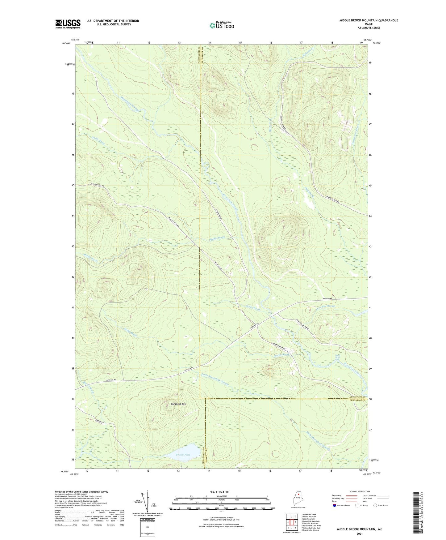
2021 topographic map quadrangle Middle Brook Mountain in the state of Maine. Scale: 1:24000. Based on the newly updated USGS 7.5' US Topo map series, this map is in the following counties: Aroostook, Piscataquis, Penobscot. The map contains contour data, water features, and other items you are used to seeing on USGS maps, but also has updated roads and other features. This is the next generation of topographic maps. Printed on high-quality waterproof paper with UV fade-resistant inks.
Quads adjacent to this one:
West: Mooseleuk Mountain
Northwest: Mooseleuk Lake
North: Round Mountain
Northeast: Jack Mountain
East: Chandler Mountain
Southeast: Grand Lake Seboeis
South: Millinocket Lake East
Southwest: Millinocket Lake West
Contains the following named places: Boars Head Falls, Brown Pond, Cedar Brook, Chandler Stream, Deadwater Brook, Little Mooseleuk Stream, Middle Brook, Middle Brook Mountain, Mooseleuk Tote Road, Pinkham Camp, Rocky Brook, Smith Brook, T9 R8 WELS