MyTopo
Millinocket Lake East Maine US Topo Map
Couldn't load pickup availability
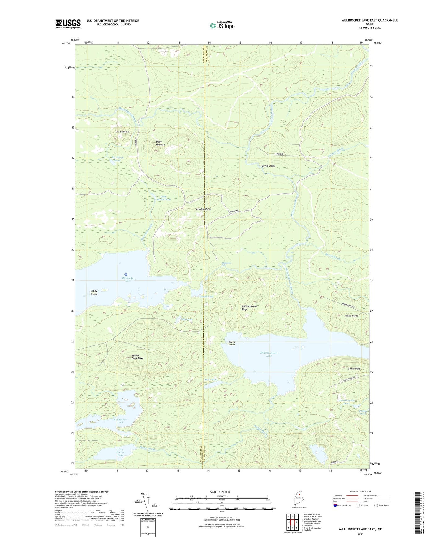
2024 topographic map quadrangle Millinocket Lake East in the state of Maine. Scale: 1:24000. Based on the newly updated USGS 7.5' US Topo map series, this map is in the following counties: Penobscot, Piscataquis. The map contains contour data, water features, and other items you are used to seeing on USGS maps, but also has updated roads and other features. This is the next generation of topographic maps. Printed on high-quality waterproof paper with UV fade-resistant inks.
Quads adjacent to this one:
West: Millinocket Lake West
Northwest: Mooseleuk Mountain
North: Middle Brook Mountain
Northeast: Chandler Mountain
East: Grand Lake Seboeis
Southeast: Hay Lake
South: Trout Brook Mountain
Southwest: Frost Pond
This map covers the same area as the classic USGS quad with code o46068c7.
Contains the following named places: Atkins Ridge, Beaver Brook, Beaver Pond Ridge, Big Beaver Pond, Big Marsh Pond, Boody Brook, Devils Elbow, Green Island, Ireland Pond, Isthmus Brook, Libby Camp, Libby Island, Libby Pinnacle, Little Beaver Pond, Little Bog Brook, Little Marsh Pond, Millimagassett Lake, Millimagassett Ridge, Millimagassett Stream, Millinocket Falls, Millinocket Lake, Millinocket Lake Dam, Millinocket Stream, Moosehorn Crossing, Munsungan Lake Tote Road, Munsungan Stream, Number One Camp, Old Baldface, Round Pond, Soule Pond, Soule Ridge, T7 R8 WELS, T8 R8 WELS, Tilly Pond, West Sawtelle Pond, Woodlot Ridge