MyTopo
Round Mountain Maine US Topo Map
Couldn't load pickup availability
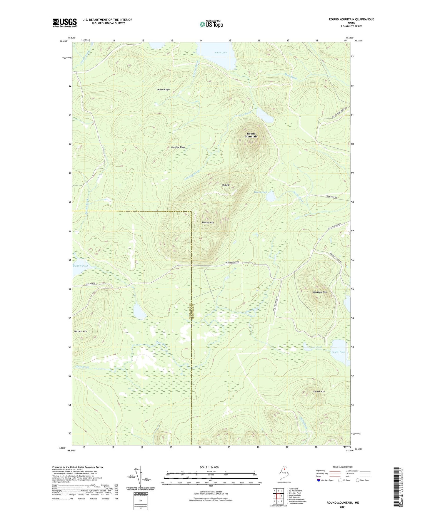
2024 topographic map quadrangle Round Mountain in the state of Maine. Scale: 1:24000. Based on the newly updated USGS 7.5' US Topo map series, this map is in the following counties: Aroostook, Piscataquis. The map contains contour data, water features, and other items you are used to seeing on USGS maps, but also has updated roads and other features. This is the next generation of topographic maps. Printed on high-quality waterproof paper with UV fade-resistant inks.
Quads adjacent to this one:
West: Mooseleuk Lake
Northwest: Farrar Pond
North: Big Machias Lake
Northeast: Greenlaw Pond
East: Jack Mountain
Southeast: Chandler Mountain
South: Middle Brook Mountain
Southwest: Mooseleuk Mountain
This map covers the same area as the classic USGS quad with code o46068e7.
Contains the following named places: Bartlett Mountain, Bartlett Pond, Center Mountain, Center Pond, Conners Brook, Leonard Pond, Lost Pond, Lovejoy Brook, Lovejoy Ridge, Middle Mountain, Moose Ridge, Peaked Mountain, Round Mountain, Round Mountain Pond, Rowe Lake, Spectacle Mountain, T10 R8 WELS, T11 R8 WELS, Weeks Pond