MyTopo
Monmouth Maine US Topo Map
Couldn't load pickup availability
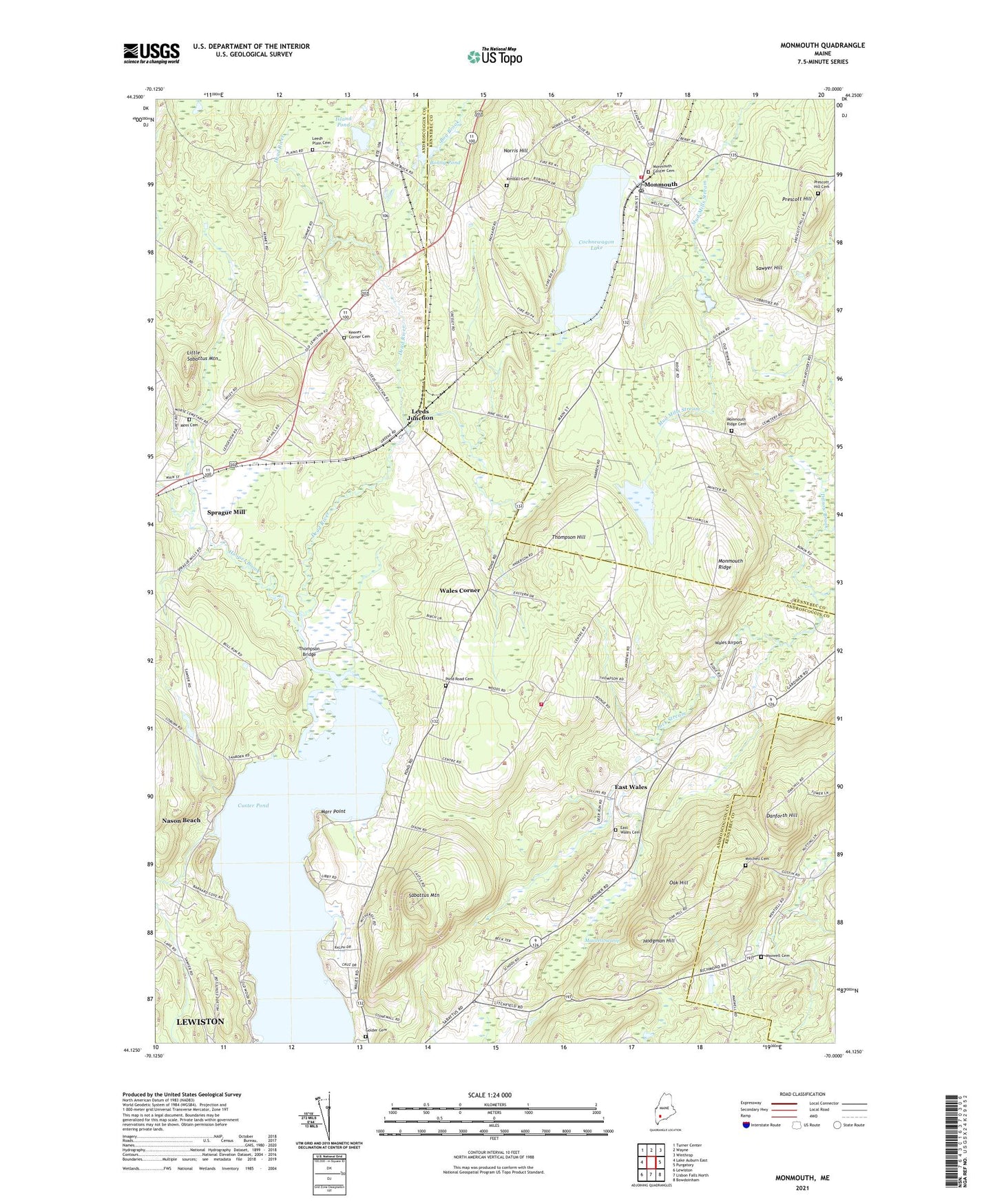
2021 topographic map quadrangle Monmouth in the state of Maine. Scale: 1:24000. Based on the newly updated USGS 7.5' US Topo map series, this map is in the following counties: Androscoggin, Kennebec. The map contains contour data, water features, and other items you are used to seeing on USGS maps, but also has updated roads and other features. This is the next generation of topographic maps. Printed on high-quality waterproof paper with UV fade-resistant inks.
Quads adjacent to this one:
West: Lake Auburn East
Northwest: Turner Center
North: Wayne
Northeast: Winthrop
East: Purgatory
Southeast: Bowdoinham
South: Lisbon Falls North
Southwest: Lewiston
Contains the following named places: Bonny Pond, Cochnewagon Dam, Cochnewagon Lake, Cumston Public Library, Custer Pond, Danforth Hill, Dead River, East Wales, East Wales Cemetery, Golder Cemetery, Hodgman Hill, Hooper Brook, Island Pond, Keenes Corner, Keenes Corner Cemetery, Kimball Cemetery, Leeds Junction, Leeds Plain Cemetery, Libby Pit, Little Sabattus Mountain, Marr Point, Martin Point, Maxwell Cemetery, Maxwell Swamp, Mitchell Cemetery, Monmouth, Monmouth Center Cemetery, Monmouth Police Department, Monmouth Post Office, Monmouth Rescue Association, Monmouth Ridge, Monmouth Ridge Cemetery, Monmouth Volunteer Fire Department Center Station, Moss Cemetery, Nason Beach, Norris Hill, Oak Hill, Oak Hill High School, Pond Road Cemetery, Prescott Hill, Prescott Hill Cemetery, Sabattus Mountain, Sawyer Hill, Sawyer Memorial Church, Sprague Mill, Thompson Bridge, Thompson Hill, Town of Monmouth, Town of Wales, University of Maine Agriculture Station, Wales Airport, Wales Central School, Wales Corner, Wales Union Church, Wales Volunteer Fire Department, WARX-FM (Lewiston), WCBB-TV (Augusta), ZIP Code: 04259