MyTopo
Mount Katahdin Maine US Topo Map
Couldn't load pickup availability
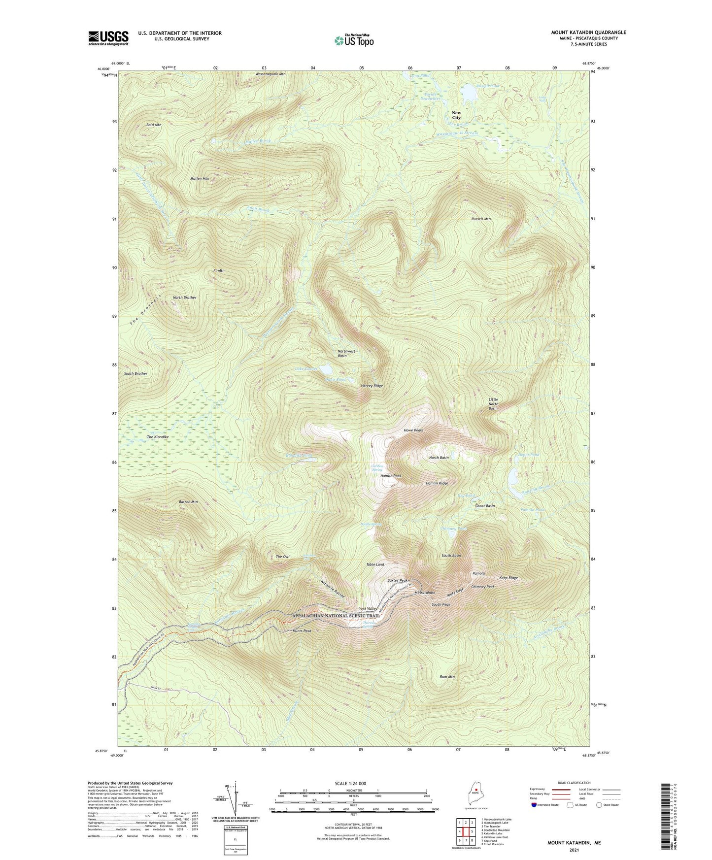
2021 topographic map quadrangle Mount Katahdin in the state of Maine. Scale: 1:24000. Based on the newly updated USGS 7.5' US Topo map series, this map is in the following counties: Piscataquis. The map contains contour data, water features, and other items you are used to seeing on USGS maps, but also has updated roads and other features. This is the next generation of topographic maps. Printed on high-quality waterproof paper with UV fade-resistant inks.
Quads adjacent to this one:
West: Doubletop Mountain
Northwest: Nesowadnehunk Lake
North: Wassataquoik Lake
Northeast: The Traveler
East: Katahdin Lake
Southeast: Trout Mountain
South: Abol Pond
Southwest: Rainbow Lake East
Contains the following named places: Abol Trail, Abot Trail, Annis Brook, Bald Mountain, Barren Mountain, Baxter Game Preserve, Baxter Peak, Caribou Spring, Cathedral Trail, Chimney Peak, Chimney Pond, Chimney Pond Campground, Chimney Pond Trail, Davis Pond, Depot Pond, Dry Pond, Dudley Trail, Fort Mountain, Great Basin, Hamlin Peak, Hamlin Ridge, Harvey Ridge, Howe, Howe Peaks, Hunts Peak, Katahdin Falls, Katahdin Stream Campground, Katahdin Stream Falls, Keep Ridge, Klondike Pond, Knife Edge, Lake Cowles, Ledge Falls, Little North Basin, Mount Katahdin, Mount Katahdin Township, Mullen Brook, Mullen Mountain, New City, North Basin, North Brother, Northwest Basin, Northwest Basin Trail, Pamola, Pamola Pond, Rum Mountain, Russell Mountain, Russell Pond, Saddle Spring, Saddle Trail, South Basin, South Branch Trail, South Branch Wassataquoik Stream, South Peak, T4 R9 WELS, Table Land, The Brothers, The Klondike, The Owl, Thoreau Spring, Turner Brook, Turner Deadwater, Wassataquoik Mountain, Witherle Ravine, York Valley