MyTopo
Katahdin Lake Maine US Topo Map
Couldn't load pickup availability
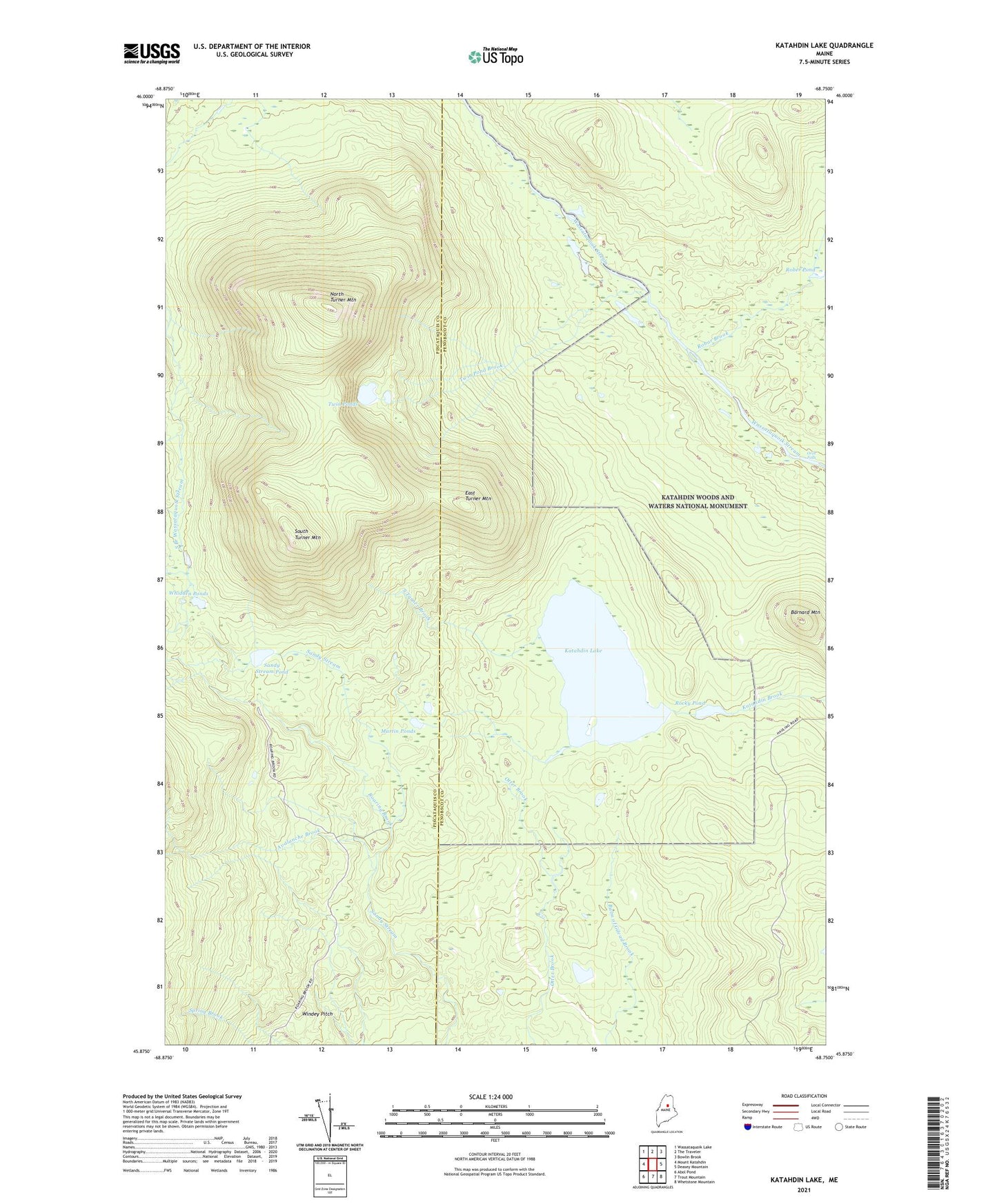
2024 topographic map quadrangle Katahdin Lake in the state of Maine. Scale: 1:24000. Based on the newly updated USGS 7.5' US Topo map series, this map is in the following counties: Penobscot, Piscataquis. The map contains contour data, water features, and other items you are used to seeing on USGS maps, but also has updated roads and other features. This is the next generation of topographic maps. Printed on high-quality waterproof paper with UV fade-resistant inks.
Quads adjacent to this one:
West: Mount Katahdin
Northwest: Wassataquoik Lake
North: The Traveler
Northeast: Bowlin Brook
East: Deasey Mountain
Southeast: Whetstone Mountain
South: Trout Mountain
Southwest: Abol Pond
This map covers the same area as the classic USGS quad with code o45068h7.
Contains the following named places: Avalanche Brook, Barnard Mountain, East Turner Mountain, Katahdin Lake, Katahdin Lake Camps, Martin Ponds, North Turner Mountain, Roaring Brook, Roaring Brook Campground, Robar Brook, Rober Pond, Rocky Pond, Sand Bank Trail, Sandy Stream Pond, South Turner Brook, South Turner Mountain, T3 R8 WELS, T4 R8 WELS, Twin Pond Brook, Twin Ponds, Whidden Ponds, Windey Pitch