MyTopo
Norridgewock Maine US Topo Map
Couldn't load pickup availability
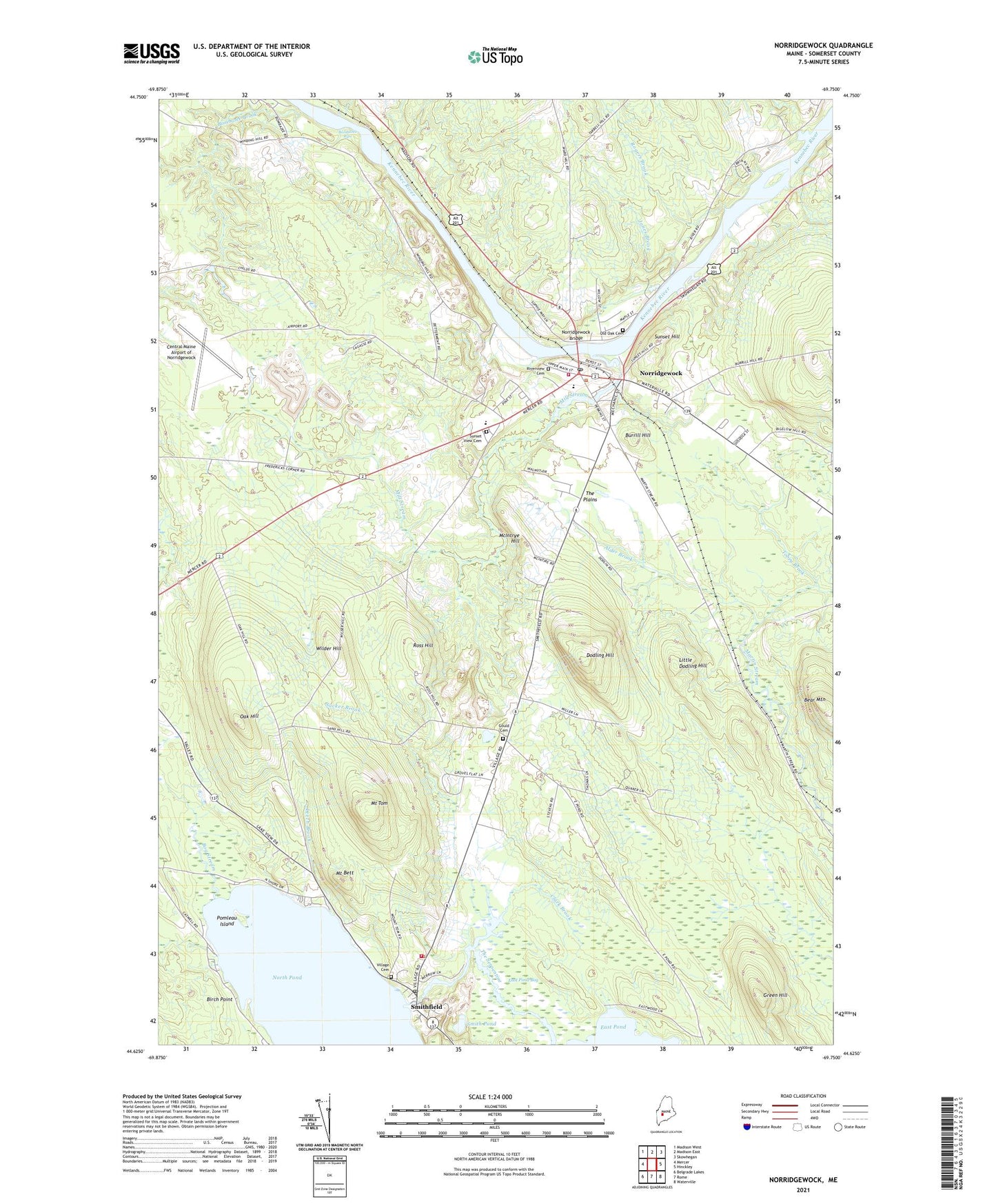
2021 topographic map quadrangle Norridgewock in the state of Maine. Scale: 1:24000. Based on the newly updated USGS 7.5' US Topo map series, this map is in the following counties: Somerset. The map contains contour data, water features, and other items you are used to seeing on USGS maps, but also has updated roads and other features. This is the next generation of topographic maps. Printed on high-quality waterproof paper with UV fade-resistant inks.
Quads adjacent to this one:
West: Mercer
Northwest: Madison West
North: Madison East
Northeast: Skowhegan
East: Hinckley
Southeast: Waterville
South: Rome
Southwest: Belgrade Lakes
Contains the following named places: Alder Brook, Bear Mountain, Birch Point, Bog Stream, Bombazee Brook, Bombazee Rips, Burrill Hill, Central Maine Airport of Norridgewock, Clark Brook, Dodling Hill, East Pond, East Pond Bog, East Pond Dam, Eaton School, Gould Cemetery, Green Hill, Jones Brook, Leech Brook, Little Dodling Hill, Little Pond, McIntrye Hill, Mill Stream, Mill Stream Dam, Mill Stream Elementary School, Mount Bett, Mount Tom, Norridgewock, Norridgewock Bridge, Norridgewock Census Designated Place, Norridgewock Fire Department, Norridgewock Free Public Library, Norridgewock Post Office, North Pond, Oak Hill, Old Oak Cemetery, Oosoola Park, Pattee Brook, Pomleau Island, Riverview Cemetery, Riverview Memorial School, Rogers Brook, Ross Hill, Smith Pond, Smithfield, Smithfield Elementary School, Smithfield Post Office, Smithfield Volunteer Fire Department, Sucker Brook, Sunset Hill, Sunset View Cemetery, The Plains, The Serpentine, Tobey Brook, Town of Norridgewock, Town of Smithfield, Turner Brook, Village Cemetery, Wilder Hill, ZIP Codes: 04957, 04978