MyTopo
Madison East Maine US Topo Map
Couldn't load pickup availability
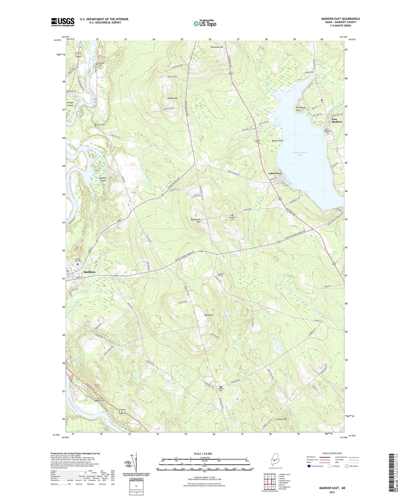
2024 topographic map quadrangle Madison East in the state of Maine. Scale: 1:24000. Based on the newly updated USGS 7.5' US Topo map series, this map is in the following counties: Somerset. The map contains contour data, water features, and other items you are used to seeing on USGS maps, but also has updated roads and other features. This is the next generation of topographic maps. Printed on high-quality waterproof paper with UV fade-resistant inks.
Quads adjacent to this one:
West: Madison West
Northwest: Embden Pond
North: Solon
Northeast: Athens
East: Skowhegan
Southeast: Hinckley
South: Norridgewock
Southwest: Mercer
This map covers the same area as the classic USGS quad with code o44069g7.
Contains the following named places: Abnaki Camping Center, Barron Corner, Black Point, Blackwell Cemetery, Blackwell Corner, Blackwell Hill, Eames Hill, East Madison, East Madison Cemetery, East Madison Dam, Ellis Corner, Forest Hill Cemetery, Jones Cemetery, Lakewood, Lakewood Golf Course, Lakewood Theater, Land of Rest Cemetery, Longley Cemetery, Madison Area Memorial High School, Madison Census Designated Place, Madison Fire Department East Madison Station, Madison Junior High School, Martin Corner, Morse Cemetery, Old Point Pond, Pooler Brook, Sandy Beach Lakeside Campground, Tarbell Hill, Thompson Point, Thurston Hill, Town of Madison, Union Church, Ward Hill, Wesserunsett and Ice Seaplane Base, Wesserunsett Lake, Weston Island, White School Corner, ZIP Code: 04950