MyTopo
Mercer Maine US Topo Map
Couldn't load pickup availability
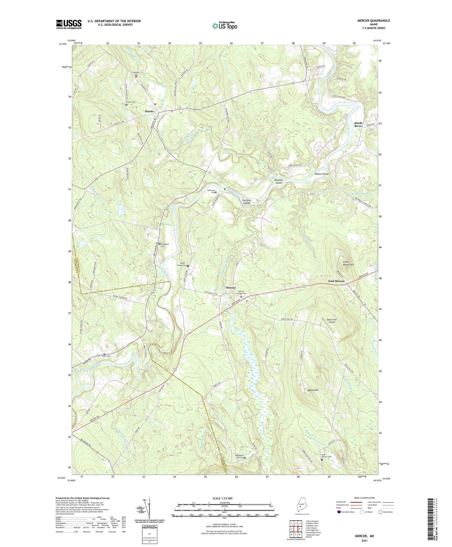
2024 topographic map quadrangle Mercer in the state of Maine. Scale: 1:24000. Based on the newly updated USGS 7.5' US Topo map series, this map is in the following counties: Somerset, Franklin. The map contains contour data, water features, and other items you are used to seeing on USGS maps, but also has updated roads and other features. This is the next generation of topographic maps. Printed on high-quality waterproof paper with UV fade-resistant inks.
Quads adjacent to this one:
West: New Sharon
Northwest: New Vineyard
North: Madison West
Northeast: Madison East
East: Norridgewock
Southeast: Rome
South: Belgrade Lakes
Southwest: Farmington Falls
This map covers the same area as the classic USGS quad with code o44069f8.
Contains the following named places: Beech Hill, Beech Hill Airport, Bog Stream, Bowden Island, Dickinson Cemetery, East Mercer, Elliot - Young Cemetery, Farrand Island, Fillibrown Brook, Frederic Cemetery, Greenleaf Cemetery, Hale Brook, Hampshire Hill Cemetery, Hilton Brook, Indian Stream, Josiah Brook, Ladd - Mercer Cemetery, Lemon Stream, Little Beech Hill, Locke Cemetery, Mercer, Mercer Bog, Mercer Bog Dam, Mercer Elementary School, Mercer Village Cemetery, Sandy River, Sandy River Dam, Sandy River Reservoir, Shaw Public Library, Starks, Starks Elementary School, Starks Volunteer Fire Department, Swan Cemetery, Town of Mercer, Town of Starks, Wiley School, Witham Brook, Witham Corner, Yeaton Island, ZIP Code: 04955