MyTopo
Palermo Maine US Topo Map
Couldn't load pickup availability
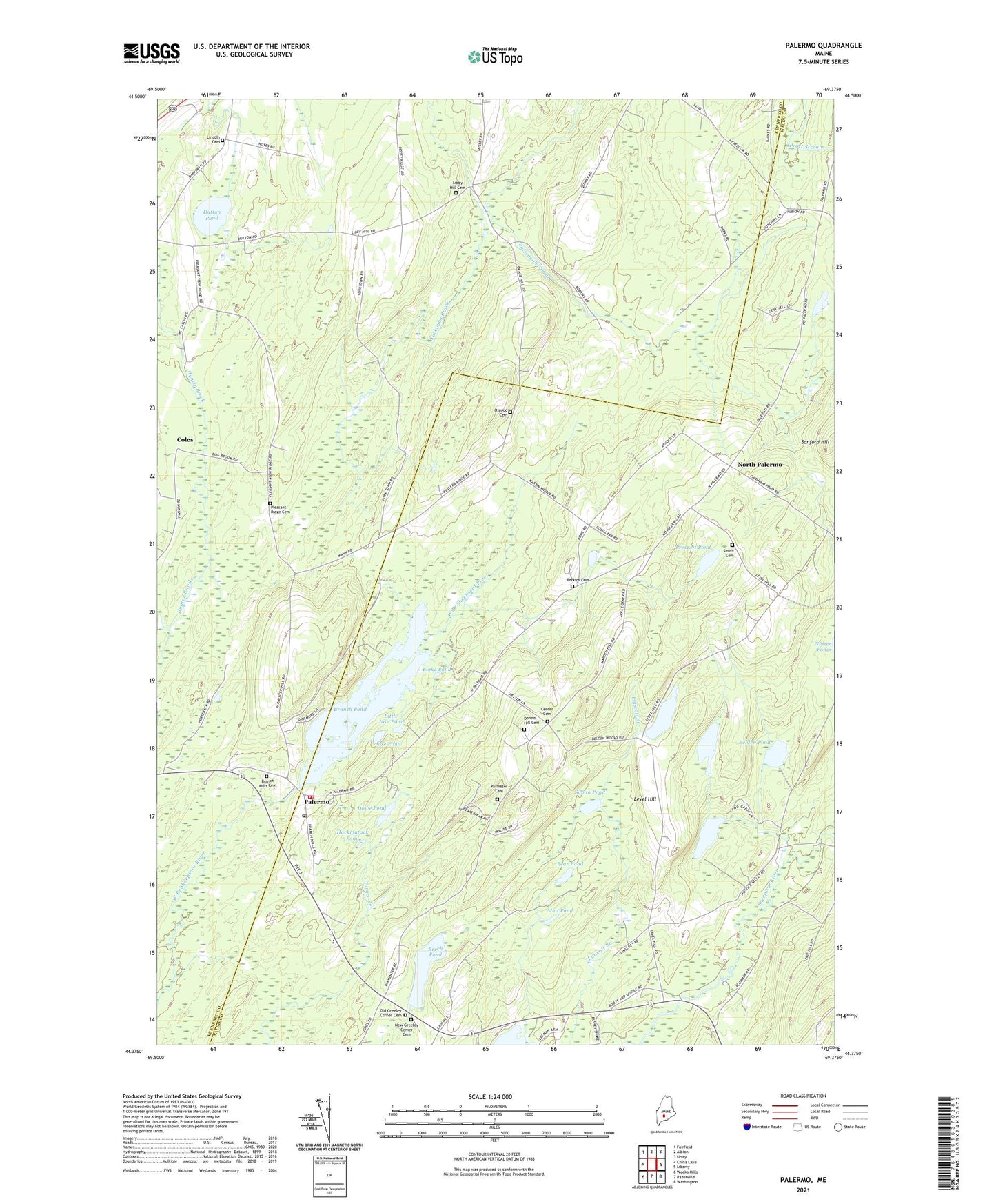
2021 topographic map quadrangle Palermo in the state of Maine. Scale: 1:24000. Based on the newly updated USGS 7.5' US Topo map series, this map is in the following counties: Waldo, Kennebec. The map contains contour data, water features, and other items you are used to seeing on USGS maps, but also has updated roads and other features. This is the next generation of topographic maps. Printed on high-quality waterproof paper with UV fade-resistant inks.
Quads adjacent to this one:
West: China Lake
Northwest: Fairfield
North: Albion
Northeast: Unity
East: Liberty
Southeast: Washington
South: Razorville
Southwest: Weeks Mills
Contains the following named places: Bear Pond, Beech Pond, Belden Pond, Blake Pond, Bowler Pond, Branch Mills Cemetery, Branch Pond, Carrs Corner, Center Cemetery, Coles, Dennis Hill Cemetery, Dowe Pond, Dutton Pond, Foster Pond, Greely Church, Greely Corner, Hackmatack Pond, Hutchins Corner, Jose Pond, Jump Pond, Level Hill, Libby Hill Cemetery, Lincoln Cemetery, Little Jose Pond, Mill Dam, Mud Pond, New Greeley Corner Cemetery, North Palermo, Old Greeley Corner Cemetery, Osgood Cemetery, Palermo, Palermo Consolidated School, Palermo First Respond Ambulance Service, Palermo Post Office, Palermo Volunteer Fire Department Central Station, Parmeter Cemetery, Perkins Cemetery, Pleasant Ridge Cemetery, Prescott Pond, Saban Pond, Sanford Hill, Sennetts Corner, Smith Cemetery, Town of Palermo, Yorktown Brook, ZIP Code: 04354