MyTopo
Liberty Maine US Topo Map
Couldn't load pickup availability
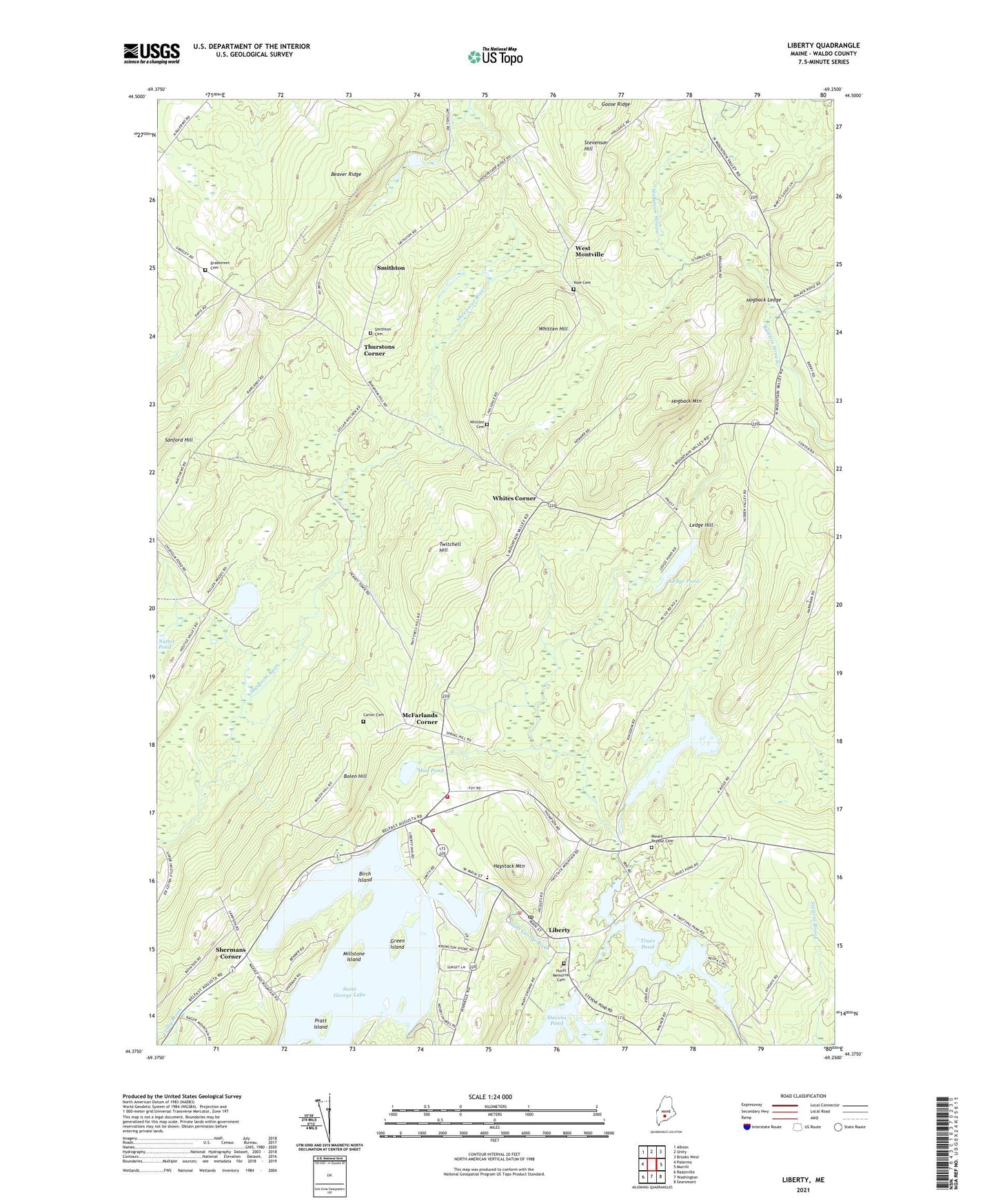
2024 topographic map quadrangle Liberty in the state of Maine. Scale: 1:24000. Based on the newly updated USGS 7.5' US Topo map series, this map is in the following counties: Waldo. The map contains contour data, water features, and other items you are used to seeing on USGS maps, but also has updated roads and other features. This is the next generation of topographic maps. Printed on high-quality waterproof paper with UV fade-resistant inks.
Quads adjacent to this one:
West: Palermo
Northwest: Albion
North: Unity
Northeast: Brooks West
East: Morrill
Southeast: Searsmont
South: Washington
Southwest: Razorville
This map covers the same area as the classic USGS quad with code o44069d3.
Contains the following named places: Beans Corner, Beaver Ridge, Birch Island, Bolen Hill, Bradstreet Cemetery, Carter Cemetery, Chisholm Pond, Clarks Corner, Green Island, Gregorys Corner, Haystack Mountain, Hogback Ledge, Hogback Mountain, Hunts Memorial Cemetery, Ivan O Davis Liberty Library, Kingdom Bog, Kingdom Bog Dam, Lake Saint George State Park, Ledge Hill, Ledge Pond, Liberty, Liberty Post Office, Liberty Volunteer Ambulance Service, Liberty Volunteer Fire Station, Little Pond, McFarlands Corner, Millstone Island, Montville Volunteer Fire Department, Mount Repose Cemetery, Mud Pond, Nutter Pond, Polands Corner, Pratt Island, Saint George Lake, Saint George Lake Dam, Shermans Corner, Smithton, Smithton Cemetery, Stevens Pond Dam, Stevenson Hill, The Kingdom, Thurstons Corner, Town of Freedom, Town of Montville, Trues Pond, Trues Pond Dam, Twitchell Hill, Vose Cemetery, Walker Elementary School, West Montville, Whites Corner, Whitten Cemetery, Whitten Hill, ZIP Code: 04941