MyTopo
Weeks Mills Maine US Topo Map
Couldn't load pickup availability
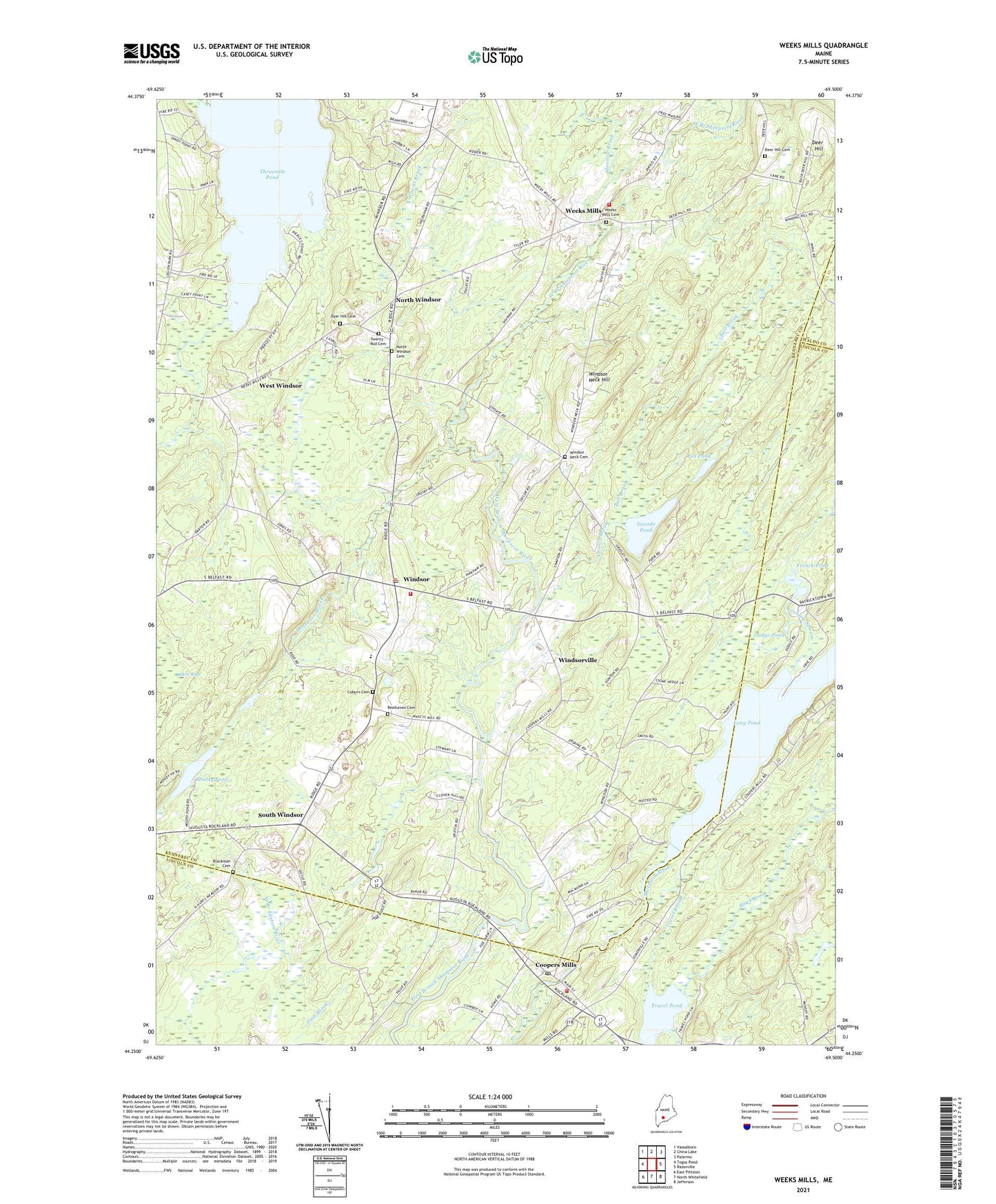
2024 topographic map quadrangle Weeks Mills in the state of Maine. Scale: 1:24000. Based on the newly updated USGS 7.5' US Topo map series, this map is in the following counties: Kennebec, Lincoln, Waldo. The map contains contour data, water features, and other items you are used to seeing on USGS maps, but also has updated roads and other features. This is the next generation of topographic maps. Printed on high-quality waterproof paper with UV fade-resistant inks.
Quads adjacent to this one:
West: Togus Pond
Northwest: Vassalboro
North: China Lake
Northeast: Palermo
East: Razorville
Southeast: Jefferson
South: North Whitefield
Southwest: East Pittston
This map covers the same area as the classic USGS quad with code o44069c5.
Contains the following named places: Black Brook, Blackman Cemetery, Brann Brook, Bull Brook, China Volunteer Fire Department Weeks Mills Station, Choate Brook, Coburn Cemetery, Coopers Mills, Coopers Mills Dam, Coopers Mills Fire Department, Cooper's Mills Post Office, Dearborn Brook, Deer Hill, Deer Hill Cemetery, Dodge Pond, Dyer Hill Cemetery, Erskine Academy, Fox Pond, French Pond, Halls Corner, Hewitt Brook, Long Pond, Lovejoy Stream, Meadow Brook, Moody Pond, North Windsor, North Windsor Cemetery, Resthaven Cemetery, Savade Pond, South Windsor, Threemile Pond, Town of Windsor, Travel Brook, Travel Pond, Weeks Mills, Weeks Mills Cemetery, West Windsor, Windsor, Windsor Elementary School, Windsor Fairgrounds, Windsor Neck Cemetery, Windsor Neck Hill, Windsor Post Office, Windsor Station, Windsor Volunteer Fire Department, Windsorville, ZIP Code: 04363