MyTopo
Phillips Maine US Topo Map
Couldn't load pickup availability
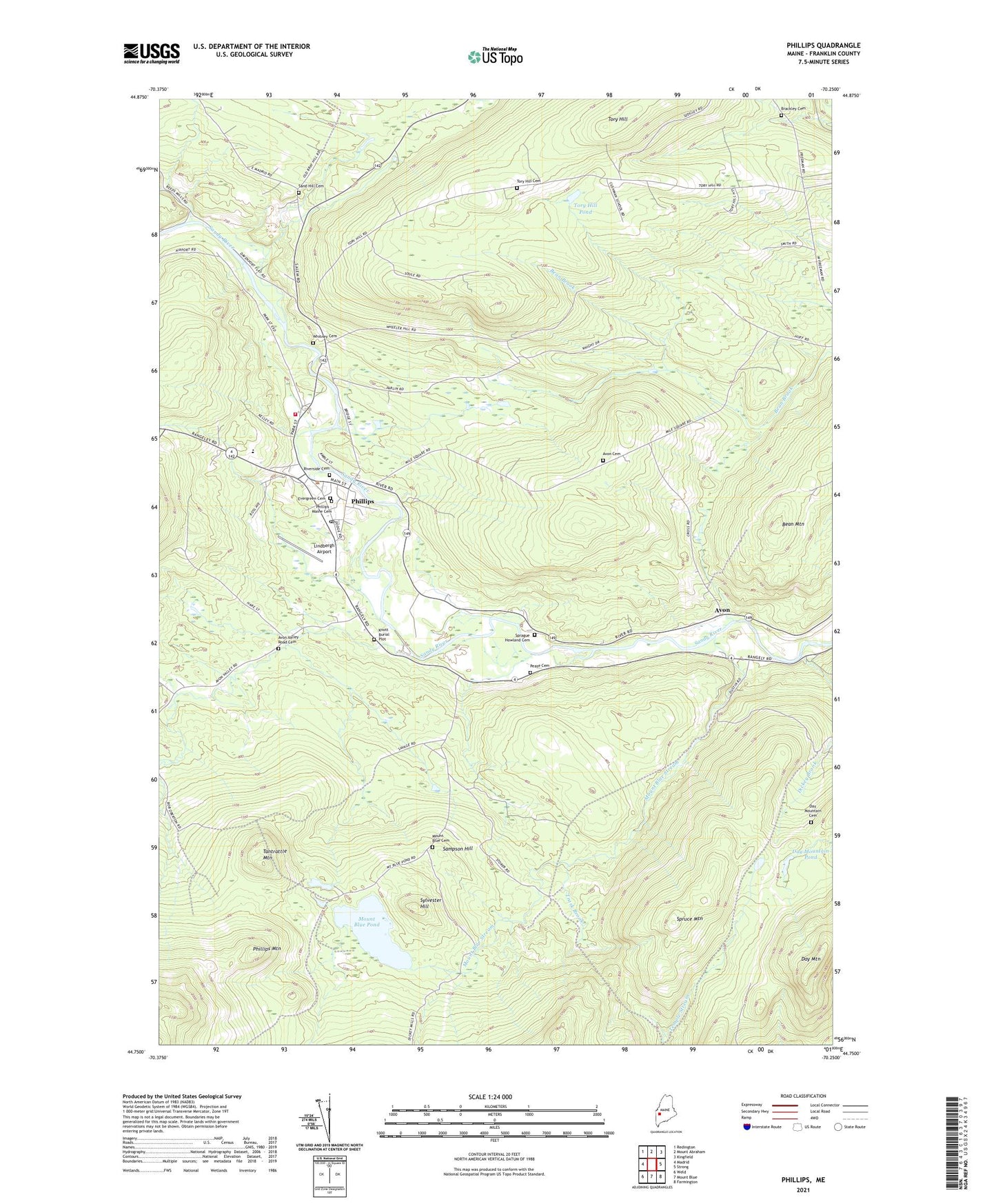
2021 topographic map quadrangle Phillips in the state of Maine. Scale: 1:24000. Based on the newly updated USGS 7.5' US Topo map series, this map is in the following counties: Franklin. The map contains contour data, water features, and other items you are used to seeing on USGS maps, but also has updated roads and other features. This is the next generation of topographic maps. Printed on high-quality waterproof paper with UV fade-resistant inks.
Quads adjacent to this one:
West: Madrid
Northwest: Redington
North: Mount Abraham
Northeast: Kingfield
East: Strong
Southeast: Farmington
South: Mount Blue
Southwest: Weld
Contains the following named places: Avon, Avon Cemetery, Avon Corner, Avon Valley Road Cemetery, Avon Valley School, Bean Mountain, Beaver Pond, Brackley Cemetery, Craig School, Cushman School, Day Mountain, Day Mountain Cemetery, Dickey Brook, Evergreen Cemetery, Knott Burial Plot, Lindbergh Airport, Mile Square School, Mount Blue Cemetery, Mount Blue Pond, Mount Blue Stream, Northstar Emergency Medical Services Phillips Station, Pease Cemetery, Phillips, Phillips - Maine Cemetery, Phillips Elementary School, Phillips Historical Society, Phillips Mountain, Phillips Post Office, Phillips Public Library, Phillips Volunteer Fire Department, Riverside Cemetery, Sampson Hill, Sand Hill Cemetery, Sprague Howland Cemetery, Sylvester Hill, Tantrattle Mountain, Tory Hill, Tory Hill Cemetery, Tory Hill Pond, Town of Avon, Trask Brook, Union Church, Whitney Cemetery