MyTopo
Russell Mountain Maine US Topo Map
Couldn't load pickup availability
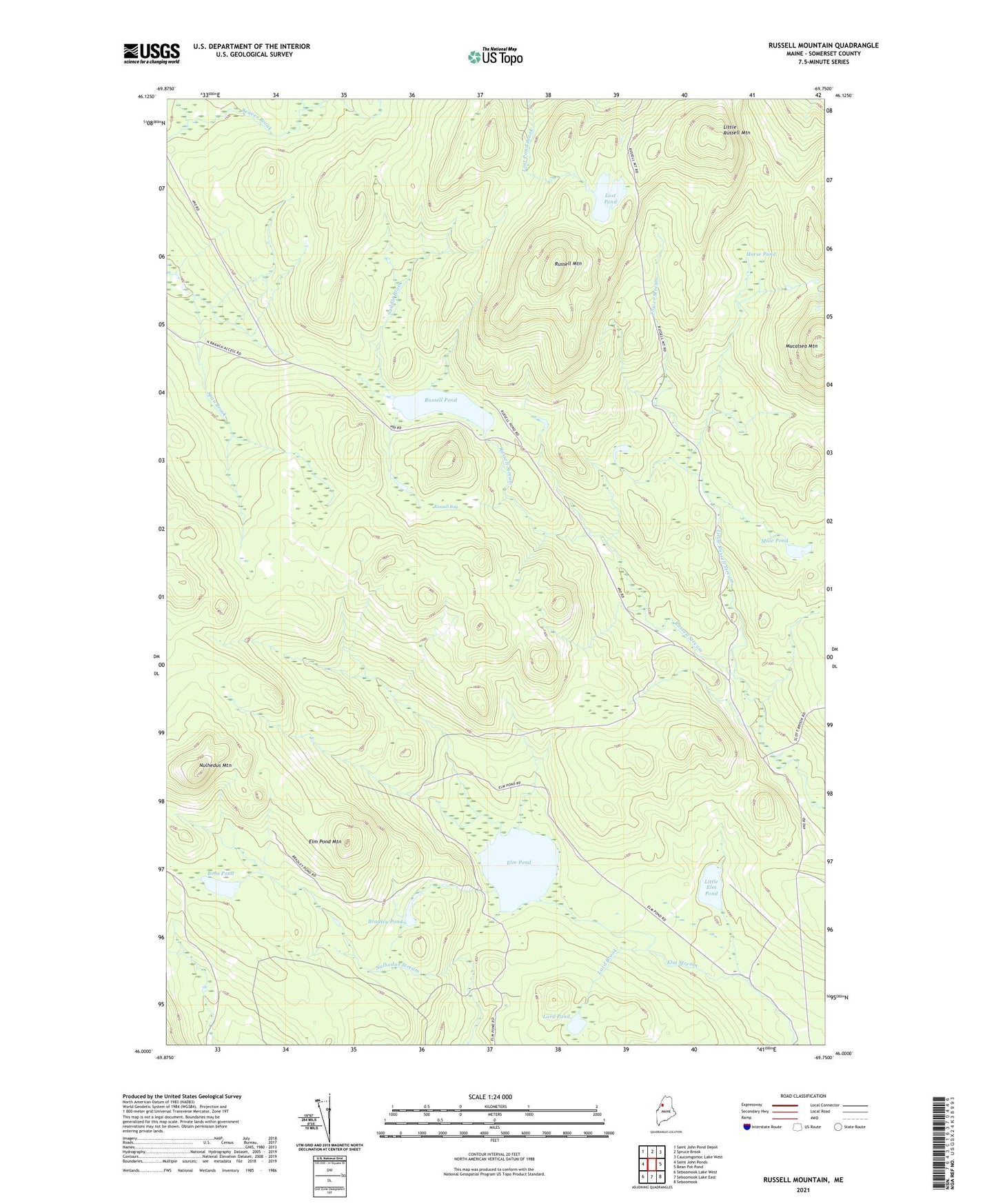
2021 topographic map quadrangle Russell Mountain in the state of Maine. Scale: 1:24000. Based on the newly updated USGS 7.5' US Topo map series, this map is in the following counties: Somerset. The map contains contour data, water features, and other items you are used to seeing on USGS maps, but also has updated roads and other features. This is the next generation of topographic maps. Printed on high-quality waterproof paper with UV fade-resistant inks.
Quads adjacent to this one:
West: Saint John Ponds
Northwest: Saint John Pond Depot
North: Spruce Brook
Northeast: Caucomgomoc Lake West
East: Bean Pot Pond
Southeast: Seboomook
South: Seboomook Lake East
Southwest: Seboomook Lake West
Contains the following named places: Bobs Pond, Bradley Pond, Elm Pond, Elm Pond Mountain, Elm Stream Township, Horse Pond, Lard Brook, Lard Pond, Little Elm Pond, Little Russell Mountain, Little Russell Stream, Lost Pond, Mucalsea Mountain, Mule Brook, Mule Pond, Nulhedus Mountain, Russell Bog, Russell Mountain, Russell Pond, Russell Pond Township, Saddle Brook, Span Brook, Tower Stream