MyTopo
Seboomook Maine US Topo Map
Couldn't load pickup availability
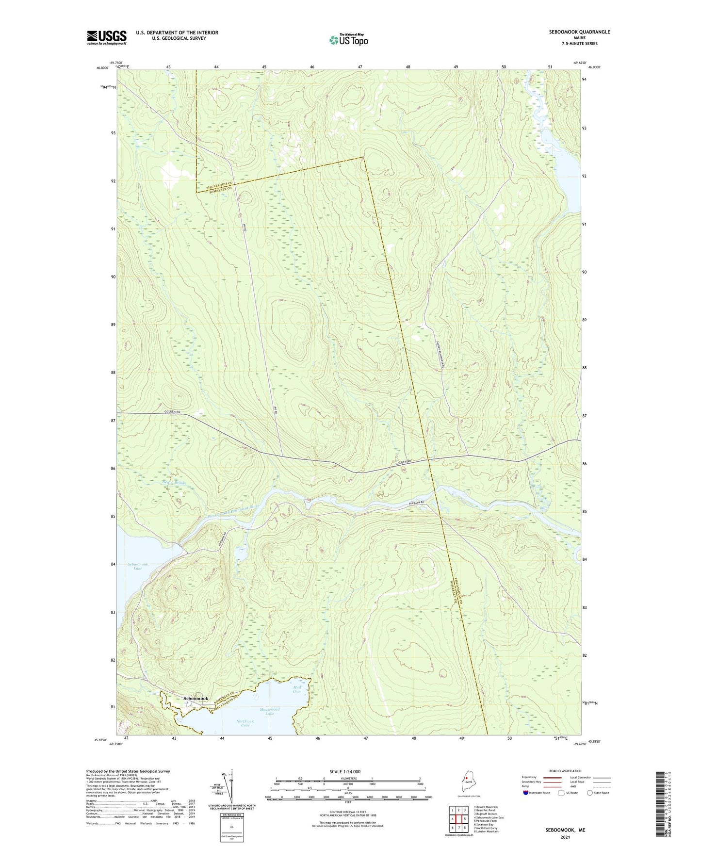
2024 topographic map quadrangle Seboomook in the state of Maine. Scale: 1:24000. Based on the newly updated USGS 7.5' US Topo map series, this map is in the following counties: Somerset, Piscataquis. The map contains contour data, water features, and other items you are used to seeing on USGS maps, but also has updated roads and other features. This is the next generation of topographic maps. Printed on high-quality waterproof paper with UV fade-resistant inks.
Quads adjacent to this one:
West: Seboomook Lake East
Northwest: Russell Mountain
North: Bean Pot Pond
Northeast: Ragmuff Stream
East: Penobscot Farm
Southeast: Lobster Mountain
South: North East Carry
Southwest: Socatean Bay
This map covers the same area as the classic USGS quad with code o45069h6.
Contains the following named places: Carry Brook, Cassidy Dam, Cassidy Deadwater, Elm Stream, Luther Brook, Mud Cove, Negro Brook, Old Roll Dam, Russell Stream, Seboomook, Seboomook Dam, Seboomook Township, T4 R15 WELS