MyTopo
Searsmont Maine US Topo Map
Couldn't load pickup availability
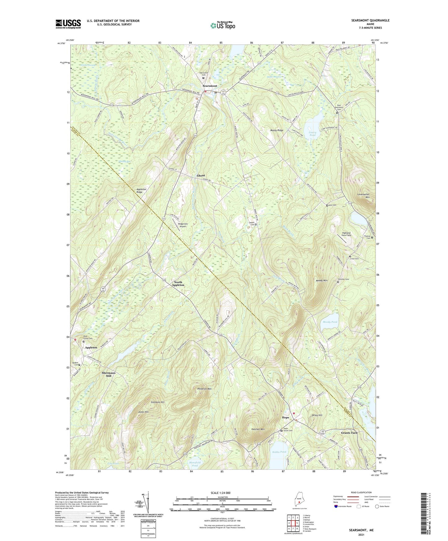
2021 topographic map quadrangle Searsmont in the state of Maine. Scale: 1:24000. Based on the newly updated USGS 7.5' US Topo map series, this map is in the following counties: Waldo, Knox. The map contains contour data, water features, and other items you are used to seeing on USGS maps, but also has updated roads and other features. This is the next generation of topographic maps. Printed on high-quality waterproof paper with UV fade-resistant inks.
Quads adjacent to this one:
West: Washington
Northwest: Liberty
North: Morrill
Northeast: Belfast
East: Lincolnville
Southeast: Camden
South: West Rockport
Southwest: Union
Contains the following named places: Ames Elementary School, Appleton Ridge, Athearns Corner, Ben Hur Heliport, Bickfords Corner, Black Brook, Church of the Nazarene, Cross Cemetery, East Searsmont Cemetery, Fletcher Cemetery, Ghent, Grants Turn, Greers Corner, Gushees Corner, Hatchet Mountain, Highland View Field, Hope, Hope Community Bible Church, Hope Grove Cemetery, Hope Library, Hope Volunteer Fire Department, Jam Brook, Jones Hill, Knights Corner, Lassell Cemetery, Lawry Pond, Levenseller Pond, Luce Brook, Mansfield Pond, Maple Meadow, Marriners Brook, Mildred Stevens Williams Memorial Library, Mill Pond, Mill Pond Dam, Moody Mountain, Moody Pond, Muzzy Ridge, North Appleton, North Hope Corner, Oak Grove Cemetery, Payson Corner, Pease Brook, Philbrick Mountain, Pine Grove Cemetery, Pitmans Corner, Quaker Cemetery, Quantabacook Lake Dam, Ridgeview Airport, Robbins Mill Dam, Saint George River Reservoir, Searsmont, Searsmont Post Office, Searsmont Town Library, Searsmont Volunteer Fire Department, Shermans Mill, Simmons Hill, Slab City, Stearns Brook, Thomas Cemetery, Town of Hope, Town of Searsmont, Whitney Bog, Wiley Brook, Wiley Hill, ZIP Code: 04973